Guanaceví geodata
Guanaceví (Durango) is a seat of a second-order administrative division; located in Mexico in America/Monterrey (GMT-6) time zone. With population of 2,908 people, there are 3064 cities with bigger population in this country. Compared to other cities in Mexico, 95% of cities are located further ↓South; 93.7% of cities are located further →East and 77.6% of cities have lower elevation than Guanaceví. Note1


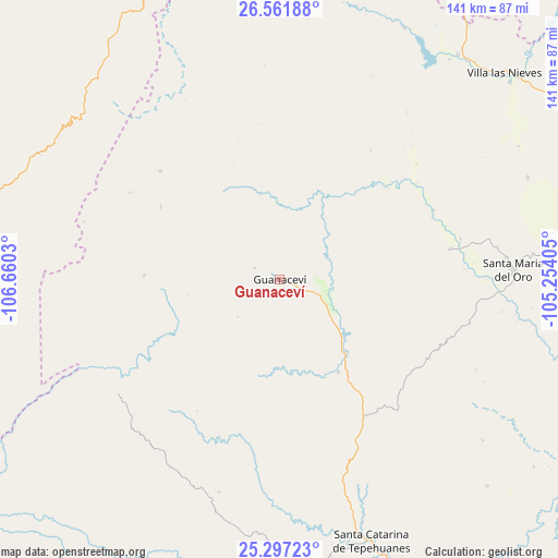
Guanaceví GPS coordinates[2]
25° 55' 52.5" North, 105° 57' 25.812" West
| Map corner | latitude | longitude |
|---|---|---|
| Upper-left | 26.56188°, | -106.6603° |
| Center: | 25.93125°, | -105.95717° |
| Lower-right: | 25.29723°, | -105.25405° |
| Map W x H: | 140.6×140.6 km | = 87.4×87.4mi |
| max Lat: | 32.7° ⇑5% North |
| Guanaceví: | 25.93125° |
| min Lat: | ⇓95% South 14.53588° |
| min Long | Guanaceví | max Long |
| -117.105° | -105.95717° | -86.73105° |
| W 6.3%⇐ | ⇒93.7% E |
Elevation
Elevation of Guanaceví is 2080 m = 6824 ft, and this is 826.3 m = 2711 ft above average elevation for this country.
| Max E: |
3497 m = 11473 ft | 22.4% |
| Guanaceví | 2080 m 6824 ft | |
| Avg. | 1253.7 m = 4113 ft | |
Min E: |
-1 m = -3 ft | 77.6% |
See also: Mexico elevation on elevation.city.
Geographical zone
Guanaceví is located in North temperate zone (between Tropic of Cancer and the Arctic Circle). Distance of this Northern Tropic circle is 277.4 km =172.4 mi to South.| Distance of | km | miles | from Guanaceví |
|---|---|---|---|
| North Pole | 7123.8 | 4426.5 | to North |
| Arctic Circle | 4517.9 | 2807.3 | to North |
| Tropic Cancer | 277.4 | 172.4 | to South |
| Equator | 2883.3 | 1791.6 | to South |


Nearby cities:
15 places around Guanaceví: (largest is in red/bold)
• Arroyo de Lajas
34 km =21.1 mi,  272°
272°
• Canutillo
76.7 km =47.7 mi,  49°
49°
• Ejido El Vergel
73.6 km =45.7 mi,  324°
324°
• General Escobedo
85.3 km =53 mi,  122°
122°
• Indé
73.4 km =45.6 mi,  91°
91°
• Las Yerbitas [Aserradero]
83.8 km =52.1 mi,  281°
281°
• Los Herrera
96.9 km =60.2 mi,  151°
151°
• Revolución
92.7 km =57.6 mi,  70°
70°
• San Bernardo
43.9 km =27.3 mi,  79°
79°
• San Pedro de Chinatú (Ranchería San Pedro)
72.1 km =44.8 mi,  293°
293°
• Santa Catarina de Tepehuanes
69.8 km =43.4 mi,  160°
160°
• Santa María del Oro
59.3 km =36.8 mi, 88°
• Torreón de Cañas
84.2 km =52.3 mi, 54°
• Turuachi
77.9 km =48.4 mi, 286°
• Villa Ocampo
72.3 km =44.9 mi,  38°
38°
Sources, notices
• [Note1] Compared only with cities in Mexico existing in our database
• [Src1] Map data: © OpenStreetMap contributors (CC-BY-SA)
• [Src2] Other city data from geonames.org with taken over terms of usage.
• [Src3] Geographical zone / Annual Mean Temperature by Robert A. Rohde @ Wikipedia
