Monte Verde geodata
Monte Verde (Chihuahua) is a populated place; located in Mexico in America/Chihuahua (GMT-6) time zone. With population of 1,087 people, there are 8009 cities with bigger population in this country. Compared to other cities in Mexico, 98.9% of cities are located further ↓South; 96.6% of cities are located further →East and 50.3% of cities have higher elevation than Monte Verde. Note1


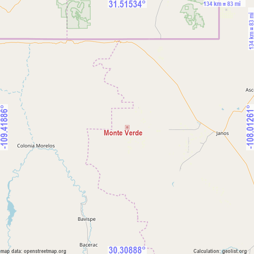
Monte Verde GPS coordinates[2]
30° 54' 50.436" North, 108° 42' 56.628" West
| Map corner | latitude | longitude |
|---|---|---|
| Upper-left | 31.51534°, | -109.41886° |
| Center: | 30.91401°, | -108.71573° |
| Lower-right: | 30.30888°, | -108.01261° |
| Map W x H: | 134.1×134.1 km | = 83.3×83.3mi |
| max Lat: | 32.7° ⇑1.1% North |
| Monte Verde: | 30.91401° |
| min Lat: | ⇓98.9% South 14.53588° |
| min Long | Monte Verde | max Long |
| -117.105° | -108.71573° | -86.73105° |
| W 3.4%⇐ | ⇒96.6% E |
Elevation
Elevation of Monte Verde is 1415 m = 4642 ft, and this is 161.3 m = 529 ft above average elevation for this country.
| Max E: |
3497 m = 11473 ft | 50.3% |
| Monte Verde | 1415 m 4642 ft | |
| Avg. | 1253.7 m = 4113 ft | |
Min E: |
-1 m = -3 ft | 49.7% |
See also: Mexico elevation on elevation.city.
Geographical zone
Monte Verde is located in North temperate zone (between Tropic of Cancer and the Arctic Circle). Distance of this Northern Tropic circle is 831.4 km =516.6 mi to South.| Distance of | km | miles | from Monte Verde |
|---|---|---|---|
| North Pole | 6569.7 | 4082.2 | to North |
| Arctic Circle | 3963.9 | 2463.1 | to North |
| Tropic Cancer | 831.4 | 516.6 | to South |
| Equator | 3437.3 | 2135.8 | to South |


Nearby cities:
15 places around Monte Verde: (largest is in red/bold)
• Agua Prieta
91.8 km =57 mi,  300°
300°
• Ascención
72.8 km =45.2 mi,  73°
73°
• Ascensión
71.3 km =44.3 mi, 73°
• Bacerac
65.4 km =40.6 mi,  198°
198°
• Bavispe
52.9 km =32.9 mi, 203°
• Casas Grandes
93.6 km =58.2 mi,  129°
129°
• Esqueda
86 km =53.4 mi,  255°
255°
• Fernández Leal
41.7 km =25.9 mi,  99°
99°
• Fronteras
80.5 km =50 mi,  268°
268°
• Huachinera
81.6 km =50.7 mi, 196°
• Janos
49.8 km =30.9 mi,  93°
93°
• Juárez
90.7 km =56.4 mi,  137°
137°
• Nuevo Casas Grandes
94.8 km =58.9 mi, 125°
• Pancho Villa
14.1 km =8.8 mi,  151°
151°
• Tres Álamos
41 km =25.5 mi, 104°
Sources, notices
• [Note1] Compared only with cities in Mexico existing in our database
• [Src1] Map data: © OpenStreetMap contributors (CC-BY-SA)
• [Src2] Other city data from geonames.org with taken over terms of usage.
• [Src3] Geographical zone / Annual Mean Temperature by Robert A. Rohde @ Wikipedia
