Felipe Carrillo Puerto geodata
Felipe Carrillo Puerto (Nayarit) is a populated place; located in Mexico in America/Mazatlan (GMT-7) time zone. With population of 1,154 people, there are 7513 cities with bigger population in this country. Compared to other cities in Mexico, 78.3% of cities are located further ↓South; 91.7% of cities are located further →East and 62.5% of cities have higher elevation than Felipe Carrillo Puerto. Note1
Current local time in Felipe Carrillo Puerto:
05:45 AM, WednesdayDifference from your time zone: hours


Felipe Carrillo Puerto GPS coordinates[2]
21° 7' 55.2" North, 104° 51' 38.448" West
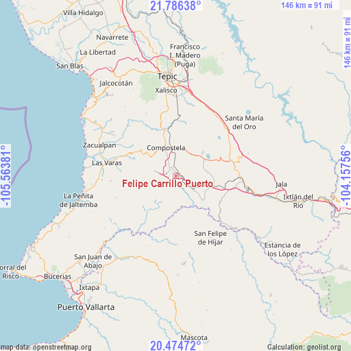
| Map corner | latitude | longitude |
|---|---|---|
| Upper-left | 21.78638°, | -105.56381° |
| Center: | 21.132°, | -104.86068° |
| Lower-right: | 20.47472°, | -104.15756° |
| Map W x H: | 145.8×145.8 km | = 90.6×90.6mi |
| max Lat: | 32.7° ⇑21.7% North |
| Felipe Carrillo Puerto: | 21.132° |
| min Lat: | ⇓78.3% South 14.53588° |
| min Long | Felipe Carrillo | max Long |
| -117.105° | -104.86068° | -86.73105° |
| W 8.3%⇐ | ⇒91.7% E |
Elevation
Elevation of Felipe Carrillo Puerto is 855 m = 2805 ft, and this is 398.7 m = 1308 ft below average elevation for this country.
| Max E: |
3497 m = 11473 ft | 62.5% |
| Avg. | 1253.7 m = 4113 ft | |
| Felipe Carrillo Puerto | 855 m = 2805 ft | |
Min E: |
-1 m = -3 ft | 37.5% |
See also: Mexico elevation on elevation.city.
Geographical zone
Felipe Carrillo Puerto is located in North Torrid zone (between Equator and Tropic of Cancer). Distance of this Northern Tropic circle is 256.3 km =159.3 mi to North.| Distance of | km | miles | from Felipe Carrillo Puerto |
|---|---|---|---|
| North Pole | 7657.4 | 4758.1 | to North |
| Arctic Circle | 5051.5 | 3138.9 | to North |
| Tropic Cancer | 256.3 | 159.3 | to North |
| Equator | 2349.7 | 1460 | to South |


Nearby cities:
15 places around Felipe Carrillo Puerto: (largest is in red/bold)
• Chapalilla
23.9 km =14.9 mi,  74°
74°
• Compostela
12.5 km =7.8 mi,  340°
340°
• Cuastecomate
14.9 km =9.3 mi,  131°
131°
• Emiliano Zapata
26.4 km =16.4 mi,  348°
348°
• Juan Escutia (Borbollón)
4 km =2.5 mi, 350°
• La Curva
25.4 km =15.8 mi,  5°
5°
• Las Piedras
25.4 km =15.8 mi,  287°
287°
• Mazatán
9.3 km =5.8 mi,  281°
281°
• Miravalles
17.1 km =10.6 mi, 353°
• San Pedro Lagunillas
14.8 km =9.2 mi,  49°
49°
• Santa Isabel
24.8 km =15.4 mi,  82°
82°
• Tequilita
8.2 km =5.1 mi, 127°
• Tetitlán
25.4 km =15.8 mi,  90°
90°
• Valle Verde
24.9 km =15.5 mi, 92°
• Zapotán
4.7 km =2.9 mi,  182°
182°
Sources, notices
• [Note1] Compared only with cities in Mexico existing in our database
• [Src1] Map data: © OpenStreetMap contributors (CC-BY-SA)
• [Src2] Other city data from geonames.org with taken over terms of usage.
• [Src3] Geographical zone / Annual Mean Temperature by Robert A. Rohde @ Wikipedia
