El Tule geodata
El Tule (Jalisco) is a populated place; located in Mexico in America/Mexico_City (GMT-6) time zone. With population of 1,498 people, there are 5763 cities with bigger population in this country. Compared to other cities in Mexico, 57.5% of cities are located further ↓South; 92.5% of cities are located further →East and 82.2% of cities have higher elevation than El Tule. Note1


El Tule GPS coordinates[2]
20° 1' 41.556" North, 105° 14' 38.832" West
| Map corner | latitude | longitude |
|---|---|---|
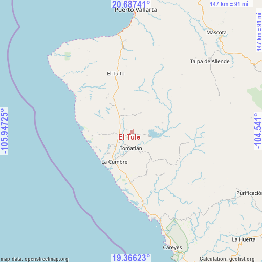
| Upper-left | 20.68741°, | -105.94725° |
| Center: | 20.02821°, | -105.24412° |
| Lower-right: | 19.36623°, | -104.541° |
| Map W x H: | 146.9×146.9 km | = 91.3×91.3mi |
| max Lat: | 32.7° ⇑42.5% North |
| El Tule: | 20.02821° |
| min Lat: | ⇓57.5% South 14.53588° |
| min Long | El Tule | max Long |
| -117.105° | -105.24412° | -86.73105° |
| W 7.5%⇐ | ⇒92.5% E |
Elevation
Elevation of El Tule is 68 m = 223 ft, and this is 1185.7 m = 3890 ft below average elevation for this country.
| Max E: |
3497 m = 11473 ft | 82.2% |
| Avg. | 1253.7 m = 4113 ft | |
| El Tule | 68 m = 223 ft | |
Min E: |
-1 m = -3 ft | 17.8% |
See also: Mexico elevation on elevation.city.
Geographical zone
El Tule is located in North Torrid zone (between Equator and Tropic of Cancer). Distance of this Northern Tropic circle is 379 km =235.5 mi to North.| Distance of | km | miles | from El Tule |
|---|---|---|---|
| North Pole | 7780.1 | 4834.3 | to North |
| Arctic Circle | 5174.2 | 3215.1 | to North |
| Tropic Cancer | 379 | 235.5 | to North |
| Equator | 2226.9 | 1383.7 | to South |


Nearby cities:
15 places around El Tule: (largest is in red/bold)
• Campo Acosta
28.6 km =17.8 mi,  181°
181°
• El Tequesquite
7.3 km =4.5 mi,  305°
305°
• El Tuito
33.6 km =20.9 mi,  345°
345°
• Gargantillo
10.7 km =6.6 mi,  263°
263°
• José María Morelos
39.4 km =24.5 mi,  170°
170°
• José María Pino Suárez (Nuevo Nahuapa)
12.4 km =7.7 mi,  224°
224°
• La Cruz de Loreto
22.2 km =13.8 mi, 264°
• La Cumbre
19.3 km =12 mi,  208°
208°
• La Gloria
16.4 km =10.2 mi,  234°
234°
• Llano Grande
38.6 km =24 mi,  88°
88°
• Llano de los Laureles
32 km =19.9 mi, 347°
• Lázaro Cárdenas
23.9 km =14.9 mi,  158°
158°
• Perula
50.2 km =31.2 mi, 165°
• San Rafael de los Moreno
11.5 km =7.1 mi,  26°
26°
• Tomatlán
10.2 km =6.3 mi, 183°
Sources, notices
• [Note1] Compared only with cities in Mexico existing in our database
• [Src1] Map data: © OpenStreetMap contributors (CC-BY-SA)
• [Src2] Other city data from geonames.org with taken over terms of usage.
• [Src3] Geographical zone / Annual Mean Temperature by Robert A. Rohde @ Wikipedia
