Llano Grande geodata
Llano Grande (Jalisco) is a populated place; located in Mexico in America/Mexico_City (GMT-6) time zone. With population of 923 people, there are 9459 cities with bigger population in this country. Compared to other cities in Mexico, 57.7% of cities are located further ↓South; 91.7% of cities are located further →East and 72.4% of cities have higher elevation than Llano Grande. Note1


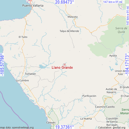
Llano Grande GPS coordinates[2]
20° 2' 8.016" North, 104° 52' 29.46" West
| Map corner | latitude | longitude |
|---|---|---|
| Upper-left | 20.69473°, | -105.57798° |
| Center: | 20.03556°, | -104.87485° |
| Lower-right: | 19.37361°, | -104.17173° |
| Map W x H: | 146.9×146.9 km | = 91.3×91.3mi |
| max Lat: | 32.7° ⇑42.3% North |
| Llano Grande: | 20.03556° |
| min Lat: | ⇓57.7% South 14.53588° |
| min Long | Llano Grande | max Long |
| -117.105° | -104.87485° | -86.73105° |
| W 8.3%⇐ | ⇒91.7% E |
Elevation
Elevation of Llano Grande is 314 m = 1030 ft, and this is 939.7 m = 3083 ft below average elevation for this country.
| Max E: |
3497 m = 11473 ft | 72.4% |
| Avg. | 1253.7 m = 4113 ft | |
| Llano Grande | 314 m = 1030 ft | |
Min E: |
-1 m = -3 ft | 27.6% |
See also: Mexico elevation on elevation.city.
Geographical zone
Llano Grande is located in North Torrid zone (between Equator and Tropic of Cancer). Distance of this Northern Tropic circle is 378.2 km =235 mi to North.| Distance of | km | miles | from Llano Grande |
|---|---|---|---|
| North Pole | 7779.3 | 4833.8 | to North |
| Arctic Circle | 5173.4 | 3214.6 | to North |
| Tropic Cancer | 378.2 | 235 | to North |
| Equator | 2227.7 | 1384.2 | to South |


Nearby cities:
15 places around Llano Grande: (largest is in red/bold)
• Campo Acosta
49 km =30.4 mi,  233°
233°
• El Salto
51.2 km =31.8 mi,  49°
49°
• El Tequesquite
44.6 km =27.7 mi,  274°
274°
• El Tule
38.6 km =24 mi, 268°
• Gargantillo
49.3 km =30.6 mi, 267°
• José María Pino Suárez (Nuevo Nahuapa)
48.3 km =30 mi,  258°
258°
• La Cumbre
51 km =31.7 mi,  249°
249°
• Los Volcanes
47.5 km =29.5 mi, 47°
• Lázaro Cárdenas
37.6 km =23.4 mi, 232°
• Ocotes
43.1 km =26.8 mi,  3°
3°
• Purificación
45.2 km =28.1 mi,  141°
141°
• San Miguel
42.5 km =26.4 mi,  158°
158°
• San Rafael de los Moreno
34.8 km =21.6 mi,  285°
285°
• Talpa de Allende
38.8 km =24.1 mi,  8°
8°
• Tomatlán
40.7 km =25.3 mi, 254°
Sources, notices
• [Note1] Compared only with cities in Mexico existing in our database
• [Src1] Map data: © OpenStreetMap contributors (CC-BY-SA)
• [Src2] Other city data from geonames.org with taken over terms of usage.
• [Src3] Geographical zone / Annual Mean Temperature by Robert A. Rohde @ Wikipedia
