Villa de la Paz geodata
Villa de la Paz (San Luis Potosí) is a seat of a second-order administrative division; located in Mexico in America/Mexico_City (GMT-6) time zone. With population of 3,734 people, there are 2459 cities with bigger population in this country. Compared to other cities in Mexico, 89.2% of cities are located further ↓South; 71.2% of cities are located further →East and 65.1% of cities have lower elevation than Villa de la Paz. Note1


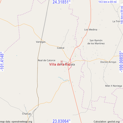
Villa de la Paz GPS coordinates[2]
23° 40' 34.176" North, 100° 42' 42.012" West
| Map corner | latitude | longitude |
|---|---|---|
| Upper-left | 24.31851°, | -101.4148° |
| Center: | 23.67616°, | -100.71167° |
| Lower-right: | 23.03064°, | -100.00855° |
| Map W x H: | 143.2×143.2 km | = 89×89mi |
| max Lat: | 32.7° ⇑10.8% North |
| Villa de la Paz: | 23.67616° |
| min Lat: | ⇓89.2% South 14.53588° |
| min Long | Villa de la Paz | max Long |
| -117.105° | -100.71167° | -86.73105° |
| W 28.8%⇐ | ⇒71.2% E |
Elevation
Elevation of Villa de la Paz is 1831 m = 6007 ft, and this is 577.3 m = 1894 ft above average elevation for this country.
| Max E: |
3497 m = 11473 ft | 34.9% |
| Villa de la Paz | 1831 m 6007 ft | |
| Avg. | 1253.7 m = 4113 ft | |
Min E: |
-1 m = -3 ft | 65.1% |
See also: Mexico elevation on elevation.city.
Geographical zone
Villa de la Paz is located in North temperate zone (between Tropic of Cancer and the Arctic Circle). Distance of this Northern Tropic circle is 26.6 km =16.5 mi to South.| Distance of | km | miles | from Villa de la Paz |
|---|---|---|---|
| North Pole | 7374.5 | 4582.3 | to North |
| Arctic Circle | 4768.6 | 2963.1 | to North |
| Tropic Cancer | 26.6 | 16.5 | to South |
| Equator | 2632.5 | 1635.8 | to South |


Nearby cities:
15 places around Villa de la Paz: (largest is in red/bold)
• Cedral
16.2 km =10.1 mi,  355°
355°
• Estación Wadley
29.2 km =18.1 mi,  255°
255°
• La Yerba
36.3 km =22.6 mi,  39°
39°
• Matehuala
7.6 km =4.7 mi,  114°
114°
• Medina
50.3 km =31.3 mi, 42°
• Real de Catorce
17.9 km =11.1 mi,  274°
274°
• Sacramento
7.9 km =4.9 mi,  151°
151°
• San Cayetano de Vacas
41.3 km =25.7 mi, 43°
• San Isidro
22.1 km =13.7 mi,  343°
343°
• San Ramón de los Martínez
46 km =28.6 mi,  60°
60°
• Santa Cruz
46.1 km =28.6 mi,  168°
168°
• Tanque Colorado
15.8 km =9.8 mi,  187°
187°
• Vanegas
33.7 km =20.9 mi,  313°
313°
• Villa de Guadalupe
33.9 km =21.1 mi, 187°
• Zaragoza de Solís
48.9 km =30.4 mi, 194°
Sources, notices
• [Note1] Compared only with cities in Mexico existing in our database
• [Src1] Map data: © OpenStreetMap contributors (CC-BY-SA)
• [Src2] Other city data from geonames.org with taken over terms of usage.
• [Src3] Geographical zone / Annual Mean Temperature by Robert A. Rohde @ Wikipedia
