Estación Wadley geodata
Estación Wadley (San Luis Potosí) is a populated place; located in Mexico in America/Mexico_City (GMT-6) time zone. With population of 567 people, there are 15067 cities with bigger population in this country. Compared to other cities in Mexico, 89.1% of cities are located further ↓South; 73.4% of cities are located further →East and 65% of cities have lower elevation than Estación Wadley. Note1


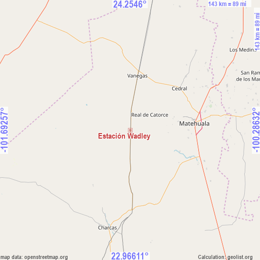
Estación Wadley GPS coordinates[2]
23° 36' 42.984" North, 100° 59' 21.984" West
| Map corner | latitude | longitude |
|---|---|---|
| Upper-left | 24.2546°, | -101.69257° |
| Center: | 23.61194°, | -100.98944° |
| Lower-right: | 22.96611°, | -100.28632° |
| Map W x H: | 143.3×143.3 km | = 89×89mi |
| max Lat: | 32.7° ⇑10.9% North |
| Estación Wadley: | 23.61194° |
| min Lat: | ⇓89.1% South 14.53588° |
| min Long | Estación Wadle | max Long |
| -117.105° | -100.98944° | -86.73105° |
| W 26.6%⇐ | ⇒73.4% E |
Elevation
Elevation of Estación Wadley is 1830 m = 6004 ft, and this is 576.3 m = 1891 ft above average elevation for this country.
| Max E: |
3497 m = 11473 ft | 35% |
| Estación Wadley | 1830 m 6004 ft | |
| Avg. | 1253.7 m = 4113 ft | |
Min E: |
-1 m = -3 ft | 65% |
See also: Mexico elevation on elevation.city.
Geographical zone
Estación Wadley is located in North temperate zone (between Tropic of Cancer and the Arctic Circle). Distance of this Northern Tropic circle is 19.5 km =12.1 mi to South.| Distance of | km | miles | from Estación Wadley |
|---|---|---|---|
| North Pole | 7381.7 | 4586.8 | to North |
| Arctic Circle | 4775.8 | 2967.5 | to North |
| Tropic Cancer | 19.5 | 12.1 | to South |
| Equator | 2625.4 | 1631.3 | to South |


Nearby cities:
15 places around Estación Wadley: (largest is in red/bold)
• Cañada Verde
60.7 km =37.7 mi,  191°
191°
• Cedral
35.5 km =22.1 mi,  49°
49°
• Charcas
55.1 km =34.2 mi, 193°
• Matehuala
35.5 km =22.1 mi,  83°
83°
• Real de Catorce
13.6 km =8.5 mi, 50°
• Sacramento
32.1 km =19.9 mi,  89°
89°
• San Isidro
35.7 km =22.2 mi,  37°
37°
• Santa Cruz
53.6 km =33.3 mi,  135°
135°
• Tanque Colorado
27.7 km =17.2 mi,  107°
107°
• Vanegas
30.6 km =19 mi,  7°
7°
• Villa de Guadalupe
35.5 km =22.1 mi, 138°
• Villa de la Paz
29.2 km =18.1 mi, 75°
• Zaragoza (La Vaca)
48.2 km =30 mi,  351°
351°
• Zaragoza de Solís
43.5 km =27 mi,  157°
157°
• Álvaro Obregón (Estación los Charcos)
57.3 km =35.6 mi,  184°
184°
Sources, notices
• [Note1] Compared only with cities in Mexico existing in our database
• [Src1] Map data: © OpenStreetMap contributors (CC-BY-SA)
• [Src2] Other city data from geonames.org with taken over terms of usage.
• [Src3] Geographical zone / Annual Mean Temperature by Robert A. Rohde @ Wikipedia
