El Jazmín geodata
El Jazmín (Jalisco) is a populated place; located in Mexico in America/Mexico_City (GMT-6) time zone. With population of 1,061 people, there are 8225 cities with bigger population in this country. Compared to other cities in Mexico, 50.8% of cities are located further ↑North; 89.1% of cities are located further →East and 58.9% of cities have lower elevation than El Jazmín. Note1


El Jazmín GPS coordinates[2]
19° 39' 12.384" North, 103° 42' 36.216" West
| Map corner | latitude | longitude |
|---|---|---|
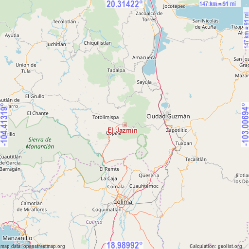
| Upper-left | 20.31422°, | -104.41319° |
| Center: | 19.65344°, | -103.71006° |
| Lower-right: | 18.98992°, | -103.00694° |
| Map W x H: | 147.2×147.3 km | = 91.5×91.5mi |
| max Lat: | 32.7° ⇑50.8% North |
| El Jazmín: | 19.65344° |
| min Lat: | ⇓49.2% South 14.53588° |
| min Long | El Jazmín | max Long |
| -117.105° | -103.71006° | -86.73105° |
| W 10.9%⇐ | ⇒89.1% E |
Elevation
Elevation of El Jazmín is 1705 m = 5594 ft, and this is 451.3 m = 1481 ft above average elevation for this country.
| Max E: |
3497 m = 11473 ft | 41.1% |
| El Jazmín | 1705 m 5594 ft | |
| Avg. | 1253.7 m = 4113 ft | |
Min E: |
-1 m = -3 ft | 58.9% |
See also: Mexico elevation on elevation.city.
Geographical zone
El Jazmín is located in North Torrid zone (between Equator and Tropic of Cancer). Distance of this Northern Tropic circle is 420.7 km =261.4 mi to North.| Distance of | km | miles | from El Jazmín |
|---|---|---|---|
| North Pole | 7821.8 | 4860.2 | to North |
| Arctic Circle | 5215.9 | 3241 | to North |
| Tropic Cancer | 420.7 | 261.4 | to North |
| Equator | 2185.3 | 1357.9 | to South |


Nearby cities:
15 places around El Jazmín: (largest is in red/bold)
• Alista
8.6 km =5.3 mi,  256°
256°
• Apango
14.1 km =8.8 mi,  359°
359°
• Ciudad Guzmán
26.6 km =16.5 mi,  77°
77°
• Ciudad Guzmán [CERESO]
22 km =13.7 mi,  90°
90°
• Copala
8 km =5 mi,  234°
234°
• Jiquilpan
15.7 km =9.8 mi,  332°
332°
• La Mesa (El Fresnito)
20.6 km =12.8 mi,  99°
99°
• Las Primaveras [Invernadero]
13.7 km =8.5 mi,  289°
289°
• San Antonio
24.4 km =15.2 mi,  310°
310°
• San Gabriel
12.1 km =7.5 mi, 330°
• San José del Carmen
21.9 km =13.6 mi,  195°
195°
• San José del Rincón
19.9 km =12.4 mi, 309°
• Teutlán
22.9 km =14.2 mi,  248°
248°
• Tolimán
22.3 km =13.9 mi, 254°
• Zapotitlán de Vadillo
15.7 km =9.8 mi,  222°
222°
Sources, notices
• [Note1] Compared only with cities in Mexico existing in our database
• [Src1] Map data: © OpenStreetMap contributors (CC-BY-SA)
• [Src2] Other city data from geonames.org with taken over terms of usage.
• [Src3] Geographical zone / Annual Mean Temperature by Robert A. Rohde @ Wikipedia
