Copala geodata
Copala (Jalisco) is a populated place; located in Mexico in America/Mexico_City (GMT-6) time zone. With population of 2,709 people, there are 3263 cities with bigger population in this country. Compared to other cities in Mexico, 51.6% of cities are located further ↑North; 89.3% of cities are located further →East and 50% of cities have lower elevation than Copala. Note1


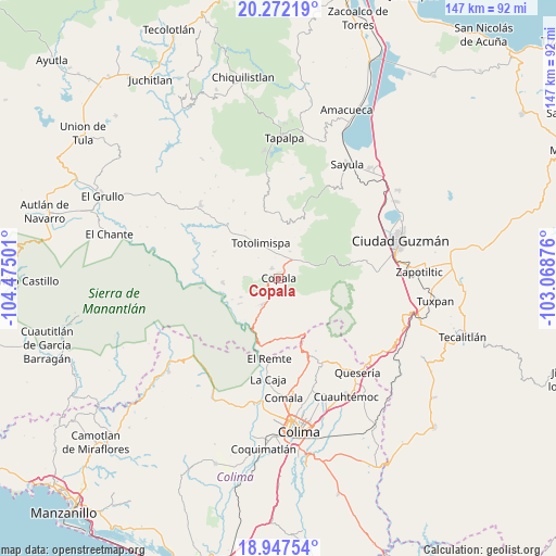
Copala GPS coordinates[2]
19° 36' 40.428" North, 103° 46' 18.768" West
| Map corner | latitude | longitude |
|---|---|---|
| Upper-left | 20.27219°, | -104.47501° |
| Center: | 19.61123°, | -103.77188° |
| Lower-right: | 18.94754°, | -103.06876° |
| Map W x H: | 147.3×147.3 km | = 91.5×91.5mi |
| max Lat: | 32.7° ⇑51.6% North |
| Copala: | 19.61123° |
| min Lat: | ⇓48.4% South 14.53588° |
| min Long | Copala | max Long |
| -117.105° | -103.77188° | -86.73105° |
| W 10.7%⇐ | ⇒89.3% E |
Elevation
Elevation of Copala is 1435 m = 4708 ft, and this is 181.3 m = 595 ft above average elevation for this country.
| Max E: |
3497 m = 11473 ft | 50% |
| Copala | 1435 m 4708 ft | |
| Avg. | 1253.7 m = 4113 ft | |
Min E: |
-1 m = -3 ft | 50% |
See also: Mexico elevation on elevation.city.
Geographical zone
Copala is located in North Torrid zone (between Equator and Tropic of Cancer). Distance of this Northern Tropic circle is 425.4 km =264.3 mi to North.| Distance of | km | miles | from Copala |
|---|---|---|---|
| North Pole | 7826.5 | 4863.2 | to North |
| Arctic Circle | 5220.6 | 3243.9 | to North |
| Tropic Cancer | 425.4 | 264.3 | to North |
| Equator | 2180.6 | 1355 | to South |


Nearby cities:
15 places around Copala: (largest is in red/bold)
• Alista
3.2 km =2 mi,  325°
325°
• Apango
19.9 km =12.4 mi,  18°
18°
• Cofradía de Suchitlán
23.6 km =14.7 mi,  161°
161°
• El Jazmín
8 km =5 mi,  54°
54°
• El Paso Real
19.7 km =12.2 mi,  267°
267°
• Jiquilpan
18.7 km =11.6 mi,  357°
357°
• Las Primaveras [Invernadero]
11.3 km =7 mi, 325°
• San Antonio
23.9 km =14.9 mi, 329°
• San Gabriel
15.2 km =9.4 mi,  1°
1°
• San José del Carmen
16.4 km =10.2 mi,  177°
177°
• San José del Rincón
19.5 km =12.1 mi, 332°
• San Pedro Toxín
20.7 km =12.9 mi,  263°
263°
• Teutlán
15.3 km =9.5 mi, 255°
• Tolimán
15.1 km =9.4 mi, 265°
• Zapotitlán de Vadillo
8 km =5 mi,  210°
210°
Sources, notices
• [Note1] Compared only with cities in Mexico existing in our database
• [Src1] Map data: © OpenStreetMap contributors (CC-BY-SA)
• [Src2] Other city data from geonames.org with taken over terms of usage.
• [Src3] Geographical zone / Annual Mean Temperature by Robert A. Rohde @ Wikipedia
