San Francisco del Progreso geodata
San Francisco del Progreso (Coahuila) is a populated place; located in Mexico in America/Monterrey (GMT-6) time zone. With population of 665 people, there are 13061 cities with bigger population in this country. Compared to other cities in Mexico, 93% of cities are located further ↓South; 81.8% of cities are located further →East and 54% of cities have higher elevation than San Francisco del Progreso. Note1
Current local time in San Francisco del Progreso:
07:22 AM, MondayDifference from your time zone: hours


San Francisco del Progreso GPS coordinates[2]
25° 35' 29.832" North, 102° 10' 15.024" West
| Map corner | latitude | longitude |
|---|---|---|
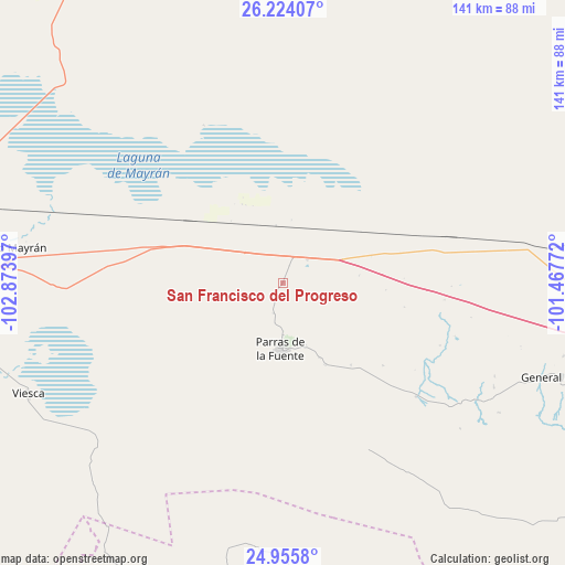
| Upper-left | 26.22407°, | -102.87397° |
| Center: | 25.59162°, | -102.17084° |
| Lower-right: | 24.9558°, | -101.46772° |
| Map W x H: | 141×141 km | = 87.6×87.6mi |
| max Lat: | 32.7° ⇑7% North |
| San Francisco del Progreso: | 25.59162° |
| min Lat: | ⇓93% South 14.53588° |
| min Long | San Francisco d | max Long |
| -117.105° | -102.17084° | -86.73105° |
| W 18.2%⇐ | ⇒81.8% E |
Elevation
Elevation of San Francisco del Progreso is 1243 m = 4078 ft, and this is 10.7 m = 35 ft below average elevation for this country.
| Max E: |
3497 m = 11473 ft | 54% |
| Avg. | 1253.7 m = 4113 ft | |
| San Francisco del Progreso | 1243 m = 4078 ft | |
Min E: |
-1 m = -3 ft | 46% |
See also: Mexico elevation on elevation.city.
Geographical zone
San Francisco del Progreso is located in North temperate zone (between Tropic of Cancer and the Arctic Circle). Distance of this Northern Tropic circle is 239.6 km =148.9 mi to South.| Distance of | km | miles | from San Francisco del Progreso |
|---|---|---|---|
| North Pole | 7161.5 | 4449.9 | to North |
| Arctic Circle | 4555.7 | 2830.8 | to North |
| Tropic Cancer | 239.6 | 148.9 | to South |
| Equator | 2845.5 | 1768.1 | to South |


Nearby cities:
15 places around San Francisco del Progreso: (largest is in red/bold)
• Ejido Emiliano Zapata
78.4 km =48.7 mi,  261°
261°
• Ejido Venustiano Carranza
83.3 km =51.8 mi,  251°
251°
• El Nilo
79 km =49.1 mi,  281°
281°
• General Cepeda
73.7 km =45.8 mi,  108°
108°
• Ignacio Zaragoza
81.6 km =50.7 mi, 278°
• Mayran
68 km =42.3 mi, 277°
• Parras de la Fuente
16.7 km =10.4 mi,  182°
182°
• San Esteban de Abajo
84.2 km =52.3 mi, 278°
• San Felipe
81.2 km =50.5 mi, 276°
• San Marcos
84.4 km =52.4 mi, 275°
• San Miguel
79.1 km =49.2 mi, 278°
• San Pedro
83.5 km =51.9 mi, 282°
• San Rafael de Abajo
84.4 km =52.4 mi, 275°
• Veintiocho de Agosto
8.5 km =5.3 mi,  45°
45°
• Viesca
69.6 km =43.2 mi, 246°
Sources, notices
• [Note1] Compared only with cities in Mexico existing in our database
• [Src1] Map data: © OpenStreetMap contributors (CC-BY-SA)
• [Src2] Other city data from geonames.org with taken over terms of usage.
• [Src3] Geographical zone / Annual Mean Temperature by Robert A. Rohde @ Wikipedia
