Coeneo de la Libertad geodata
Coeneo de la Libertad (Michoacán) is a seat of a second-order administrative division; located in Mexico in America/Mexico_City (GMT-6) time zone. With population of 3,865 people, there are 2371 cities with bigger population in this country. Compared to other cities in Mexico, 53.4% of cities are located further ↓South; 78.1% of cities are located further →East and 75.7% of cities have lower elevation than Coeneo de la Libertad. Note1


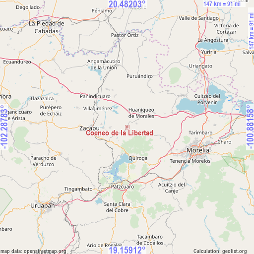
Coeneo de la Libertad GPS coordinates[2]
19° 49' 19.02" North, 101° 35' 4.92" West
| Map corner | latitude | longitude |
|---|---|---|
| Upper-left | 20.48203°, | -102.28783° |
| Center: | 19.82195°, | -101.5847° |
| Lower-right: | 19.15912°, | -100.88158° |
| Map W x H: | 147.1×147.1 km | = 91.4×91.4mi |
| max Lat: | 32.7° ⇑46.6% North |
| Coeneo de la Libertad: | 19.82195° |
| min Lat: | ⇓53.4% South 14.53588° |
| min Long | Coeneo de la Li | max Long |
| -117.105° | -101.5847° | -86.73105° |
| W 21.9%⇐ | ⇒78.1% E |
Elevation
Elevation of Coeneo de la Libertad is 2043 m = 6703 ft, and this is 789.3 m = 2590 ft above average elevation for this country.
| Max E: |
3497 m = 11473 ft | 24.3% |
| Coeneo de la Libertad | 2043 m 6703 ft | |
| Avg. | 1253.7 m = 4113 ft | |
Min E: |
-1 m = -3 ft | 75.7% |
See also: Mexico elevation on elevation.city.
Geographical zone
Coeneo de la Libertad is located in North Torrid zone (between Equator and Tropic of Cancer). Distance of this Northern Tropic circle is 401.9 km =249.7 mi to North.| Distance of | km | miles | from Coeneo de la Libertad |
|---|---|---|---|
| North Pole | 7803.1 | 4848.6 | to North |
| Arctic Circle | 5197.2 | 3229.4 | to North |
| Tropic Cancer | 401.9 | 249.7 | to North |
| Equator | 2204 | 1369.5 | to South |


Nearby cities:
15 places around Coeneo de la Libertad: (largest is in red/bold)
• Aracurio
13.4 km =8.3 mi,  113°
113°
• Bellas Fuentes
9.9 km =6.2 mi,  269°
269°
• Comanjá
13.9 km =8.6 mi,  233°
233°
• Copándaro (Copándaro del Cuatro)
11.7 km =7.3 mi,  318°
318°
• Cortijo Nuevo
12.9 km =8 mi,  250°
250°
• Cortijo Viejo
11.7 km =7.3 mi,  257°
257°
• Huaniqueo de Morales
11.8 km =7.3 mi,  45°
45°
• La Cañada
5.9 km =3.7 mi,  68°
68°
• Matugeo
10.4 km =6.5 mi,  198°
198°
• San Isidro
3.5 km =2.2 mi,  29°
29°
• Tarejero
13.7 km =8.5 mi, 268°
• Tecacho
12 km =7.5 mi,  77°
77°
• Teremendo
11.7 km =7.3 mi, 110°
• Tungüitiro
4.8 km =3 mi,  214°
214°
• Zipiajo
4.5 km =2.8 mi,  132°
132°
Sources, notices
• [Note1] Compared only with cities in Mexico existing in our database
• [Src1] Map data: © OpenStreetMap contributors (CC-BY-SA)
• [Src2] Other city data from geonames.org with taken over terms of usage.
• [Src3] Geographical zone / Annual Mean Temperature by Robert A. Rohde @ Wikipedia
