Mesa de San Pedro geodata
Mesa de San Pedro (Durango) is a populated place; located in Mexico in America/Monterrey (GMT-6) time zone. With population of 771 people, there are 11338 cities with bigger population in this country. Compared to other cities in Mexico, 88.8% of cities are located further ↓South; 93.4% of cities are located further →East and 60.8% of cities have higher elevation than Mesa de San Pedro. Note1


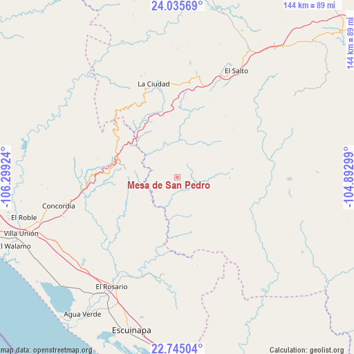
Mesa de San Pedro GPS coordinates[2]
23° 23' 30.984" North, 105° 35' 45.996" West
| Map corner | latitude | longitude |
|---|---|---|
| Upper-left | 24.03569°, | -106.29924° |
| Center: | 23.39194°, | -105.59611° |
| Lower-right: | 22.74504°, | -104.89299° |
| Map W x H: | 143.5×143.5 km | = 89.2×89.2mi |
| max Lat: | 32.7° ⇑11.2% North |
| Mesa de San Pedro: | 23.39194° |
| min Lat: | ⇓88.8% South 14.53588° |
| min Long | Mesa de San Ped | max Long |
| -117.105° | -105.59611° | -86.73105° |
| W 6.6%⇐ | ⇒93.4% E |
Elevation
Elevation of Mesa de San Pedro is 950 m = 3117 ft, and this is 303.7 m = 996 ft below average elevation for this country.
| Max E: |
3497 m = 11473 ft | 60.8% |
| Avg. | 1253.7 m = 4113 ft | |
| Mesa de San Pedro | 950 m = 3117 ft | |
Min E: |
-1 m = -3 ft | 39.2% |
See also: Mexico elevation on elevation.city.
Geographical zone
Mesa de San Pedro is located in North Torrid zone (between Equator and Tropic of Cancer). Distance of this Northern Tropic circle is 5 km =3.1 mi to North.| Distance of | km | miles | from Mesa de San Pedro |
|---|---|---|---|
| North Pole | 7406.1 | 4601.9 | to North |
| Arctic Circle | 4800.2 | 2982.7 | to North |
| Tropic Cancer | 5 | 3.1 | to North |
| Equator | 2600.9 | 1616.1 | to South |


Nearby cities:
15 places around Mesa de San Pedro: (largest is in red/bold)
• Cacalotán
43.9 km =27.3 mi,  214°
214°
• Chavarría Nuevo
28.7 km =17.8 mi,  1°
1°
• Chele
36.8 km =22.9 mi,  235°
235°
• Copala
34.4 km =21.4 mi,  270°
270°
• El Palmito
31.1 km =19.3 mi,  307°
307°
• La Ciudad
38.8 km =24.1 mi,  345°
345°
• La Petaca
21.5 km =13.4 mi,  280°
280°
• La Peña
29.9 km =18.6 mi,  48°
48°
• Matatán
42.2 km =26.2 mi,  198°
198°
• Mesillas
48.9 km =30.4 mi,  250°
250°
• Potrerillos
24.6 km =15.3 mi,  286°
286°
• Pueblo Nuevo
21.8 km =13.5 mi,  93°
93°
• San Bernardino de Milpillas Chico
45.2 km =28.1 mi, 91°
• San Jerónimo
46.9 km =29.1 mi,  6°
6°
• Santa Lucía
26.7 km =16.6 mi, 280°
Sources, notices
• [Note1] Compared only with cities in Mexico existing in our database
• [Src1] Map data: © OpenStreetMap contributors (CC-BY-SA)
• [Src2] Other city data from geonames.org with taken over terms of usage.
• [Src3] Geographical zone / Annual Mean Temperature by Robert A. Rohde @ Wikipedia
