Candela geodata
Candela (Coahuila) is a seat of a second-order administrative division; located in Mexico in America/Monterrey (GMT-6) time zone. With population of 1,492 people, there are 5785 cities with bigger population in this country. Compared to other cities in Mexico, 96.1% of cities are located further ↓South; 70.8% of cities are located further →East and 69.7% of cities have higher elevation than Candela. Note1


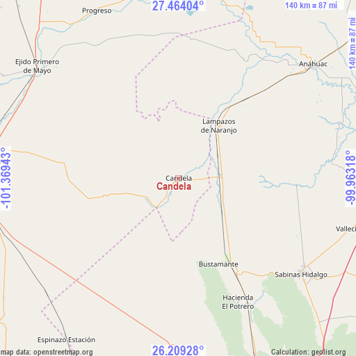
Candela GPS coordinates[2]
26° 50' 18.24" North, 100° 39' 58.68" West
| Map corner | latitude | longitude |
|---|---|---|
| Upper-left | 27.46404°, | -101.36943° |
| Center: | 26.8384°, | -100.6663° |
| Lower-right: | 26.20928°, | -99.96318° |
| Map W x H: | 139.5×139.5 km | = 86.7×86.7mi |
| max Lat: | 32.7° ⇑3.9% North |
| Candela: | 26.8384° |
| min Lat: | ⇓96.1% South 14.53588° |
| min Long | Candela | max Long |
| -117.105° | -100.6663° | -86.73105° |
| W 29.2%⇐ | ⇒70.8% E |
Elevation
Elevation of Candela is 428 m = 1404 ft, and this is 825.7 m = 2709 ft below average elevation for this country.
| Max E: |
3497 m = 11473 ft | 69.7% |
| Avg. | 1253.7 m = 4113 ft | |
| Candela | 428 m = 1404 ft | |
Min E: |
-1 m = -3 ft | 30.3% |
See also: Mexico elevation on elevation.city.
Geographical zone
Candela is located in North temperate zone (between Tropic of Cancer and the Arctic Circle). Distance of this Northern Tropic circle is 378.2 km =235 mi to South.| Distance of | km | miles | from Candela |
|---|---|---|---|
| North Pole | 7022.9 | 4363.8 | to North |
| Arctic Circle | 4417 | 2744.6 | to North |
| Tropic Cancer | 378.2 | 235 | to South |
| Equator | 2984.2 | 1854.3 | to South |


Nearby cities:
15 places around Candela: (largest is in red/bold)
• Anáhuac
69.5 km =43.2 mi,  49°
49°
• Bustamante
37.3 km =23.2 mi,  154°
154°
• Castaños
76.2 km =47.3 mi,  265°
265°
• Ciudad Sabinas Hidalgo
60.8 km =37.8 mi,  127°
127°
• Ciudad de Villaldama
44.7 km =27.8 mi, 147°
• Colonia Diana Laura Riojas de Colosio
82.2 km =51.1 mi,  280°
280°
• El Potrero
53.9 km =33.5 mi, 154°
• Frontera
78.6 km =48.8 mi, 277°
• La Cruz
84 km =52.2 mi, 281°
• Lampazos de Naranjo
26.2 km =16.3 mi,  37°
37°
• Monclova
75.2 km =46.7 mi, 275°
• Ocho de Enero
84.1 km =52.3 mi, 282°
• Primero de Mayo
70.8 km =44 mi,  308°
308°
• Progreso
73 km =45.4 mi,  334°
334°
• Vallecillo
70.3 km =43.7 mi,  106°
106°
Sources, notices
• [Note1] Compared only with cities in Mexico existing in our database
• [Src1] Map data: © OpenStreetMap contributors (CC-BY-SA)
• [Src2] Other city data from geonames.org with taken over terms of usage.
• [Src3] Geographical zone / Annual Mean Temperature by Robert A. Rohde @ Wikipedia
