El Potrero geodata
El Potrero (Nuevo León) is a populated place; located in Mexico in America/Monterrey (GMT-6) time zone. With population of 629 people, there are 13762 cities with bigger population in this country. Compared to other cities in Mexico, 95.7% of cities are located further ↓South; 68.8% of cities are located further →East and 67.5% of cities have higher elevation than El Potrero. Note1


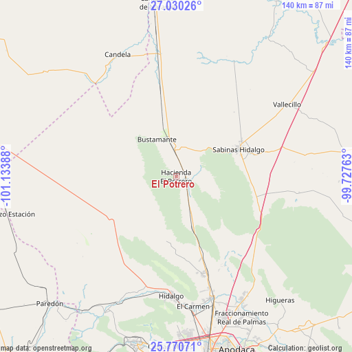
El Potrero GPS coordinates[2]
26° 24' 7.92" North, 100° 25' 50.7" West
| Map corner | latitude | longitude |
|---|---|---|
| Upper-left | 27.03026°, | -101.13388° |
| Center: | 26.4022°, | -100.43075° |
| Lower-right: | 25.77071°, | -99.72763° |
| Map W x H: | 140×140.1 km | = 87×87.1mi |
| max Lat: | 32.7° ⇑4.3% North |
| El Potrero: | 26.4022° |
| min Lat: | ⇓95.7% South 14.53588° |
| min Long | El Potrero | max Long |
| -117.105° | -100.43075° | -86.73105° |
| W 31.2%⇐ | ⇒68.8% E |
Elevation
Elevation of El Potrero is 554 m = 1818 ft, and this is 699.7 m = 2296 ft below average elevation for this country.
| Max E: |
3497 m = 11473 ft | 67.5% |
| Avg. | 1253.7 m = 4113 ft | |
| El Potrero | 554 m = 1818 ft | |
Min E: |
-1 m = -3 ft | 32.5% |
See also: Mexico elevation on elevation.city.
Geographical zone
El Potrero is located in North temperate zone (between Tropic of Cancer and the Arctic Circle). Distance of this Northern Tropic circle is 329.7 km =204.9 mi to South.| Distance of | km | miles | from El Potrero |
|---|---|---|---|
| North Pole | 7071.4 | 4394 | to North |
| Arctic Circle | 4465.5 | 2774.7 | to North |
| Tropic Cancer | 329.7 | 204.9 | to South |
| Equator | 2935.6 | 1824.1 | to South |


Nearby cities:
15 places around El Potrero: (largest is in red/bold)
• Abasolo
50.8 km =31.6 mi,  176°
176°
• Alberto Villarreal
51 km =31.7 mi, 177°
• Bustamante
16.6 km =10.3 mi,  333°
333°
• Candela
53.9 km =33.5 mi, 334°
• Carmen
52.2 km =32.4 mi,  172°
172°
• Ciudad Sabinas Hidalgo
27.2 km =16.9 mi,  65°
65°
• Ciudad de Villaldama
10.8 km =6.7 mi,  2°
2°
• Hidalgo
47.9 km =29.8 mi, 182°
• Las Torres
51.3 km =31.9 mi, 167°
• Los Morales
41 km =25.5 mi,  164°
164°
• Los Villarreales
40.5 km =25.2 mi, 164°
• Mamulique
37.3 km =23.2 mi,  147°
147°
• Mina
45.7 km =28.4 mi,  192°
192°
• Salinas Victoria
50.8 km =31.6 mi, 164°
• Vallecillo
52.6 km =32.7 mi,  56°
56°
Sources, notices
• [Note1] Compared only with cities in Mexico existing in our database
• [Src1] Map data: © OpenStreetMap contributors (CC-BY-SA)
• [Src2] Other city data from geonames.org with taken over terms of usage.
• [Src3] Geographical zone / Annual Mean Temperature by Robert A. Rohde @ Wikipedia
