Cañada Verde geodata
Cañada Verde (San Luis Potosí) is a populated place; located in Mexico in America/Mexico_City (GMT-6) time zone. With population of 664 people, there are 13077 cities with bigger population in this country. Compared to other cities in Mexico, 88.1% of cities are located further ↓South; 74.2% of cities are located further →East and 70.2% of cities have lower elevation than Cañada Verde. Note1


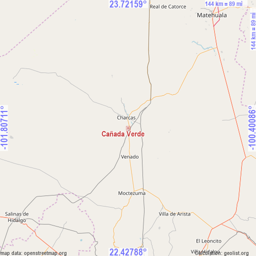
Cañada Verde GPS coordinates[2]
23° 4' 34.644" North, 101° 6' 14.328" West
| Map corner | latitude | longitude |
|---|---|---|
| Upper-left | 23.72159°, | -101.80711° |
| Center: | 23.07629°, | -101.10398° |
| Lower-right: | 22.42788°, | -100.40086° |
| Map W x H: | 143.8×143.8 km | = 89.4×89.4mi |
| max Lat: | 32.7° ⇑11.9% North |
| Cañada Verde: | 23.07629° |
| min Lat: | ⇓88.1% South 14.53588° |
| min Long | Cañada Verde | max Long |
| -117.105° | -101.10398° | -86.73105° |
| W 25.8%⇐ | ⇒74.2% E |
Elevation
Elevation of Cañada Verde is 1929 m = 6329 ft, and this is 675.3 m = 2216 ft above average elevation for this country.
| Max E: |
3497 m = 11473 ft | 29.8% |
| Cañada Verde | 1929 m 6329 ft | |
| Avg. | 1253.7 m = 4113 ft | |
Min E: |
-1 m = -3 ft | 70.2% |
See also: Mexico elevation on elevation.city.
Geographical zone
Cañada Verde is located in North Torrid zone (between Equator and Tropic of Cancer). Distance of this Northern Tropic circle is 40.1 km =24.9 mi to North.| Distance of | km | miles | from Cañada Verde |
|---|---|---|---|
| North Pole | 7441.2 | 4623.7 | to North |
| Arctic Circle | 4835.3 | 3004.5 | to North |
| Tropic Cancer | 40.1 | 24.9 | to North |
| Equator | 2565.8 | 1594.3 | to South |


Nearby cities:
15 places around Cañada Verde: (largest is in red/bold)
• Charcas
6 km =3.7 mi,  350°
350°
• Estribo
46.7 km =29 mi,  272°
272°
• González
52.6 km =32.7 mi,  160°
160°
• La Manta
51.1 km =31.8 mi,  169°
169°
• Moctezuma
36.6 km =22.7 mi,  176°
176°
• Morados
39.8 km =24.7 mi, 181°
• Polocote de Arriba
13.4 km =8.3 mi,  192°
192°
• San José del Arbolito
51.5 km =32 mi,  148°
148°
• Santa Cruz
54.2 km =33.7 mi,  66°
66°
• Santa Rita
16.3 km =10.1 mi, 153°
• Santa Rosa La Masita
51.5 km =32 mi,  79°
79°
• Venado
16.3 km =10.1 mi, 176°
• Villa de Guadalupe
48.5 km =30.1 mi,  46°
46°
• Zaragoza de Solís
34.1 km =21.2 mi,  55°
55°
• Álvaro Obregón (Estación los Charcos)
7.6 km =4.7 mi, 71°
Sources, notices
• [Note1] Compared only with cities in Mexico existing in our database
• [Src1] Map data: © OpenStreetMap contributors (CC-BY-SA)
• [Src2] Other city data from geonames.org with taken over terms of usage.
• [Src3] Geographical zone / Annual Mean Temperature by Robert A. Rohde @ Wikipedia
