San Miguel de Buenavista geodata
San Miguel de Buenavista (Nayarit) is a populated place; located in Mexico in America/Mazatlan (GMT-7) time zone. With population of 517 people, there are 16282 cities with bigger population in this country. Compared to other cities in Mexico, 77.9% of cities are located further ↓South; 90.7% of cities are located further →East and 67.9% of cities have lower elevation than San Miguel de Buenavista. Note1
Current local time in San Miguel de Buenavista:
08:01 AM, MondayDifference from your time zone: hours


San Miguel de Buenavista GPS coordinates[2]
21° 6' 5.436" North, 104° 20' 32.028" West
| Map corner | latitude | longitude |
|---|---|---|
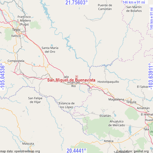
| Upper-left | 21.75603°, | -105.04536° |
| Center: | 21.10151°, | -104.34223° |
| Lower-right: | 20.4441°, | -103.63911° |
| Map W x H: | 145.9×145.9 km | = 90.7×90.7mi |
| max Lat: | 32.7° ⇑22.1% North |
| San Miguel de Buenavista: | 21.10151° |
| min Lat: | ⇓77.9% South 14.53588° |
| min Long | San Miguel de B | max Long |
| -117.105° | -104.34223° | -86.73105° |
| W 9.3%⇐ | ⇒90.7% E |
Elevation
Elevation of San Miguel de Buenavista is 1887 m = 6191 ft, and this is 633.3 m = 2078 ft above average elevation for this country.
| Max E: |
3497 m = 11473 ft | 32.1% |
| San Miguel de Buenavista | 1887 m 6191 ft | |
| Avg. | 1253.7 m = 4113 ft | |
Min E: |
-1 m = -3 ft | 67.9% |
See also: Mexico elevation on elevation.city.
Geographical zone
San Miguel de Buenavista is located in North Torrid zone (between Equator and Tropic of Cancer). Distance of this Northern Tropic circle is 259.7 km =161.4 mi to North.| Distance of | km | miles | from San Miguel de Buenavista |
|---|---|---|---|
| North Pole | 7660.8 | 4760.2 | to North |
| Arctic Circle | 5054.9 | 3141 | to North |
| Tropic Cancer | 259.7 | 161.4 | to North |
| Equator | 2346.3 | 1457.9 | to South |


Nearby cities:
15 places around San Miguel de Buenavista: (largest is in red/bold)
• Ahuacatlán
15.6 km =9.7 mi,  250°
250°
• El Rosario
26.7 km =16.6 mi,  209°
209°
• Francisco I. Madero (La Bolsa)
1.8 km =1.1 mi,  121°
121°
• Heriberto Jara
19 km =11.8 mi, 253°
• Ixtlán del Río
7.6 km =4.7 mi,  203°
203°
• Jala
9.9 km =6.2 mi,  272°
272°
• Jomulco
8.5 km =5.3 mi, 271°
• La Cofradía
2.2 km =1.4 mi,  75°
75°
• La Venta de Nochitiltic
22.4 km =13.9 mi,  114°
114°
• Los Aguajes
1.4 km =0.9 mi,  296°
296°
• Marquezado
24 km =14.9 mi,  263°
263°
• Méxpan
10.5 km =6.5 mi,  225°
225°
• Rosa Blanca
3 km =1.9 mi,  327°
327°
• Santo Tomás
26.3 km =16.3 mi, 116°
• Tequepexpan
26.8 km =16.7 mi, 298°
Sources, notices
• [Note1] Compared only with cities in Mexico existing in our database
• [Src1] Map data: © OpenStreetMap contributors (CC-BY-SA)
• [Src2] Other city data from geonames.org with taken over terms of usage.
• [Src3] Geographical zone / Annual Mean Temperature by Robert A. Rohde @ Wikipedia
