Rosa Blanca geodata
Rosa Blanca (Nayarit) is a populated place; located in Mexico in America/Mazatlan (GMT-7) time zone. With population of 2,668 people, there are 3314 cities with bigger population in this country. Compared to other cities in Mexico, 78.2% of cities are located further ↓South; 90.7% of cities are located further →East and 70.7% of cities have lower elevation than Rosa Blanca. Note1


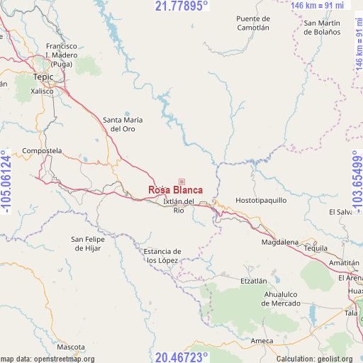
Rosa Blanca GPS coordinates[2]
21° 7' 28.344" North, 104° 21' 29.196" West
| Map corner | latitude | longitude |
|---|---|---|
| Upper-left | 21.77895°, | -105.06124° |
| Center: | 21.12454°, | -104.35811° |
| Lower-right: | 20.46723°, | -103.65499° |
| Map W x H: | 145.8×145.9 km | = 90.6×90.7mi |
| max Lat: | 32.7° ⇑21.8% North |
| Rosa Blanca: | 21.12454° |
| min Lat: | ⇓78.2% South 14.53588° |
| min Long | Rosa Blanca | max Long |
| -117.105° | -104.35811° | -86.73105° |
| W 9.3%⇐ | ⇒90.7% E |
Elevation
Elevation of Rosa Blanca is 1939 m = 6362 ft, and this is 685.3 m = 2248 ft above average elevation for this country.
| Max E: |
3497 m = 11473 ft | 29.3% |
| Rosa Blanca | 1939 m 6362 ft | |
| Avg. | 1253.7 m = 4113 ft | |
Min E: |
-1 m = -3 ft | 70.7% |
See also: Mexico elevation on elevation.city.
Geographical zone
Rosa Blanca is located in North Torrid zone (between Equator and Tropic of Cancer). Distance of this Northern Tropic circle is 257.1 km =159.8 mi to North.| Distance of | km | miles | from Rosa Blanca |
|---|---|---|---|
| North Pole | 7658.2 | 4758.6 | to North |
| Arctic Circle | 5052.3 | 3139.4 | to North |
| Tropic Cancer | 257.1 | 159.8 | to North |
| Equator | 2348.8 | 1459.5 | to South |


Nearby cities:
15 places around Rosa Blanca: (largest is in red/bold)
• Ahuacatlán
15.2 km =9.4 mi,  239°
239°
• Francisco I. Madero (La Bolsa)
4.7 km =2.9 mi,  137°
137°
• Heriberto Jara
18.4 km =11.4 mi, 244°
• Ixtlán del Río
9.6 km =6 mi,  188°
188°
• Jala
8.5 km =5.3 mi,  255°
255°
• Jomulco
7.2 km =4.5 mi,  251°
251°
• La Cofradía
4.3 km =2.7 mi,  117°
117°
• La Venta de Nochitiltic
25 km =15.5 mi, 118°
• Los Aguajes
2 km =1.2 mi,  168°
168°
• Marquezado
22.8 km =14.2 mi, 256°
• Méxpan
11.5 km =7.1 mi,  210°
210°
• San Miguel de Buenavista
3 km =1.9 mi,  147°
147°
• Tequepexpan
24.2 km =15 mi,  294°
294°
• Tetitlán
26.8 km =16.7 mi,  271°
271°
• Uzeta
25.3 km =15.7 mi, 267°
Sources, notices
• [Note1] Compared only with cities in Mexico existing in our database
• [Src1] Map data: © OpenStreetMap contributors (CC-BY-SA)
• [Src2] Other city data from geonames.org with taken over terms of usage.
• [Src3] Geographical zone / Annual Mean Temperature by Robert A. Rohde @ Wikipedia
