Los Aguajes geodata
Los Aguajes (Nayarit) is a populated place; located in Mexico in America/Mazatlan (GMT-7) time zone. With population of 1,094 people, there are 7947 cities with bigger population in this country. Compared to other cities in Mexico, 78% of cities are located further ↓South; 90.7% of cities are located further →East and 69.1% of cities have lower elevation than Los Aguajes. Note1


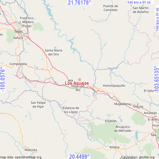
Los Aguajes GPS coordinates[2]
21° 6' 26.244" North, 104° 21' 16.092" West
| Map corner | latitude | longitude |
|---|---|---|
| Upper-left | 21.76178°, | -105.0576° |
| Center: | 21.10729°, | -104.35447° |
| Lower-right: | 20.4499°, | -103.65135° |
| Map W x H: | 145.9×145.9 km | = 90.7×90.7mi |
| max Lat: | 32.7° ⇑22% North |
| Los Aguajes: | 21.10729° |
| min Lat: | ⇓78% South 14.53588° |
| min Long | Los Aguajes | max Long |
| -117.105° | -104.35447° | -86.73105° |
| W 9.3%⇐ | ⇒90.7% E |
Elevation
Elevation of Los Aguajes is 1909 m = 6263 ft, and this is 655.3 m = 2150 ft above average elevation for this country.
| Max E: |
3497 m = 11473 ft | 30.9% |
| Los Aguajes | 1909 m 6263 ft | |
| Avg. | 1253.7 m = 4113 ft | |
Min E: |
-1 m = -3 ft | 69.1% |
See also: Mexico elevation on elevation.city.
Geographical zone
Los Aguajes is located in North Torrid zone (between Equator and Tropic of Cancer). Distance of this Northern Tropic circle is 259 km =160.9 mi to North.| Distance of | km | miles | from Los Aguajes |
|---|---|---|---|
| North Pole | 7660.2 | 4759.8 | to North |
| Arctic Circle | 5054.3 | 3140.6 | to North |
| Tropic Cancer | 259 | 160.9 | to North |
| Equator | 2346.9 | 1458.3 | to South |


Nearby cities:
15 places around Los Aguajes: (largest is in red/bold)
• Ahuacatlán
14.7 km =9.1 mi,  246°
246°
• El Rosario
26.7 km =16.6 mi,  206°
206°
• Francisco I. Madero (La Bolsa)
3.2 km =2 mi,  119°
119°
• Heriberto Jara
18 km =11.2 mi, 250°
• Ixtlán del Río
7.8 km =4.8 mi,  192°
192°
• Jala
8.6 km =5.3 mi,  268°
268°
• Jomulco
7.2 km =4.5 mi, 267°
• La Cofradía
3.4 km =2.1 mi,  91°
91°
• La Venta de Nochitiltic
23.8 km =14.8 mi,  114°
114°
• Marquezado
22.8 km =14.2 mi,  261°
261°
• Méxpan
10.1 km =6.3 mi,  218°
218°
• Rosa Blanca
2 km =1.2 mi,  348°
348°
• San Miguel de Buenavista
1.4 km =0.9 mi, 116°
• Tequepexpan
25.4 km =15.8 mi,  298°
298°
• Uzeta
25.7 km =16 mi, 271°
Sources, notices
• [Note1] Compared only with cities in Mexico existing in our database
• [Src1] Map data: © OpenStreetMap contributors (CC-BY-SA)
• [Src2] Other city data from geonames.org with taken over terms of usage.
• [Src3] Geographical zone / Annual Mean Temperature by Robert A. Rohde @ Wikipedia
