Ayotitlán geodata
Ayotitlán (Jalisco) is a populated place; located in Mexico in America/Mexico_City (GMT-6) time zone. With population of 704 people, there are 12362 cities with bigger population in this country. Compared to other cities in Mexico, 54.7% of cities are located further ↑North; 90.4% of cities are located further →East and 60.9% of cities have higher elevation than Ayotitlán. Note1


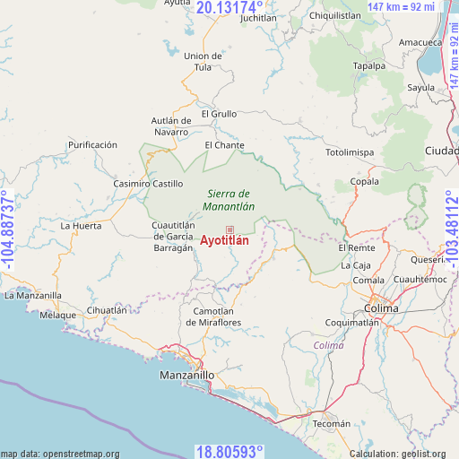
Ayotitlán GPS coordinates[2]
19° 28' 12.684" North, 104° 11' 3.264" West
| Map corner | latitude | longitude |
|---|---|---|
| Upper-left | 20.13174°, | -104.88737° |
| Center: | 19.47019°, | -104.18424° |
| Lower-right: | 18.80593°, | -103.48112° |
| Map W x H: | 147.4×147.4 km | = 91.6×91.6mi |
| max Lat: | 32.7° ⇑54.7% North |
| Ayotitlán: | 19.47019° |
| min Lat: | ⇓45.3% South 14.53588° |
| min Long | Ayotitlán | max Long |
| -117.105° | -104.18424° | -86.73105° |
| W 9.6%⇐ | ⇒90.4% E |
Elevation
Elevation of Ayotitlán is 946 m = 3104 ft, and this is 307.7 m = 1010 ft below average elevation for this country.
| Max E: |
3497 m = 11473 ft | 60.9% |
| Avg. | 1253.7 m = 4113 ft | |
| Ayotitlán | 946 m = 3104 ft | |
Min E: |
-1 m = -3 ft | 39.1% |
See also: Mexico elevation on elevation.city.
Geographical zone
Ayotitlán is located in North Torrid zone (between Equator and Tropic of Cancer). Distance of this Northern Tropic circle is 441 km =274 mi to North.| Distance of | km | miles | from Ayotitlán |
|---|---|---|---|
| North Pole | 7842.2 | 4872.9 | to North |
| Arctic Circle | 5236.3 | 3253.7 | to North |
| Tropic Cancer | 441 | 274 | to North |
| Equator | 2164.9 | 1345.2 | to South |


Nearby cities:
15 places around Ayotitlán: (largest is in red/bold)
• Ahuacapán
27.5 km =17.1 mi,  327°
327°
• Benito Juárez de Peña Colorada (El Poblado)
15.4 km =9.6 mi,  141°
141°
• Camotlán de Miraflores
28.3 km =17.6 mi,  190°
190°
• Cedros
21.5 km =13.4 mi,  195°
195°
• Chacala
19 km =11.8 mi,  213°
213°
• Cuautitlán
18.5 km =11.5 mi,  263°
263°
• Cuzalapa
14.1 km =8.8 mi,  282°
282°
• El Chante
27.6 km =17.1 mi,  356°
356°
• El Chico
17.9 km =11.1 mi,  217°
217°
• El Paso Real
27.8 km =17.3 mi,  57°
57°
• Minatitlán
16.8 km =10.4 mi,  123°
123°
• Minatitlán
16.9 km =10.5 mi,  133°
133°
• Paticajo
19 km =11.8 mi,  170°
170°
• San Pedro Toxín
26.3 km =16.3 mi, 59°
• Telcruz
6.2 km =3.9 mi,  83°
83°
Sources, notices
• [Note1] Compared only with cities in Mexico existing in our database
• [Src1] Map data: © OpenStreetMap contributors (CC-BY-SA)
• [Src2] Other city data from geonames.org with taken over terms of usage.
• [Src3] Geographical zone / Annual Mean Temperature by Robert A. Rohde @ Wikipedia
