Cedros geodata
Cedros (Colima) is a populated place; located in Mexico in America/Mexico_City (GMT-6) time zone. With population of 567 people, there are 15067 cities with bigger population in this country. Compared to other cities in Mexico, 59.2% of cities are located further ↑North; 90.5% of cities are located further →East and 71% of cities have higher elevation than Cedros. Note1


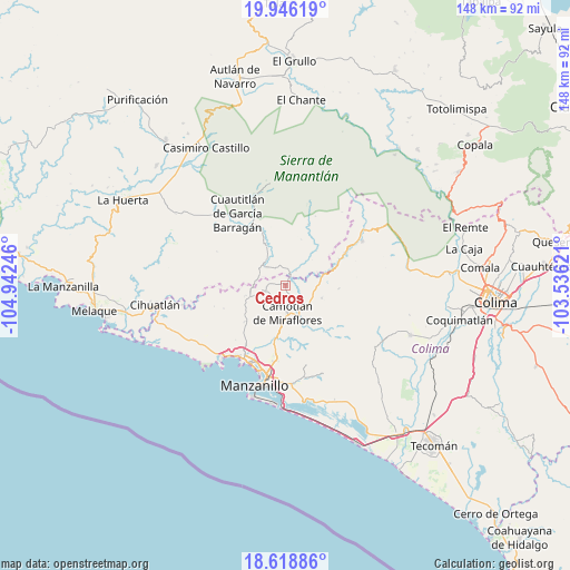
Cedros GPS coordinates[2]
19° 17' 1.932" North, 104° 14' 21.588" West
| Map corner | latitude | longitude |
|---|---|---|
| Upper-left | 19.94619°, | -104.94246° |
| Center: | 19.28387°, | -104.23933° |
| Lower-right: | 18.61886°, | -103.53621° |
| Map W x H: | 147.6×147.6 km | = 91.7×91.7mi |
| max Lat: | 32.7° ⇑59.2% North |
| Cedros: | 19.28387° |
| min Lat: | ⇓40.8% South 14.53588° |
| min Long | Cedros | max Long |
| -117.105° | -104.23933° | -86.73105° |
| W 9.5%⇐ | ⇒90.5% E |
Elevation
Elevation of Cedros is 369 m = 1211 ft, and this is 884.7 m = 2903 ft below average elevation for this country.
| Max E: |
3497 m = 11473 ft | 71% |
| Avg. | 1253.7 m = 4113 ft | |
| Cedros | 369 m = 1211 ft | |
Min E: |
-1 m = -3 ft | 29% |
See also: Mexico elevation on elevation.city.
Geographical zone
Cedros is located in North Torrid zone (between Equator and Tropic of Cancer). Distance of this Northern Tropic circle is 461.8 km =286.9 mi to North.| Distance of | km | miles | from Cedros |
|---|---|---|---|
| North Pole | 7862.9 | 4885.8 | to North |
| Arctic Circle | 5257 | 3266.5 | to North |
| Tropic Cancer | 461.8 | 286.9 | to North |
| Equator | 2144.2 | 1332.3 | to South |


Nearby cities:
15 places around Cedros: (largest is in red/bold)
• Ayotitlán
21.5 km =13.4 mi,  15°
15°
• Benito Juárez de Peña Colorada (El Poblado)
17.8 km =11.1 mi,  60°
60°
• Camotlán de Miraflores
7.1 km =4.4 mi,  176°
176°
• Chacala
6.7 km =4.2 mi,  316°
316°
• Chandiablo
14.1 km =8.8 mi,  227°
227°
• Cuautitlán
22.5 km =14 mi,  325°
325°
• El Chico
8.3 km =5.2 mi, 322°
• Francisco Villa
19.6 km =12.2 mi,  186°
186°
• Jalipa
18.2 km =11.3 mi, 189°
• Manzanillo
21.5 km =13.4 mi,  210°
210°
• Minatitlán
20.3 km =12.6 mi, 63°
• Minatitlán
23 km =14.3 mi, 59°
• Paticajo
9.2 km =5.7 mi,  77°
77°
• Tapeixtles
24.3 km =15.1 mi, 190°
• Telcruz
24.5 km =15.2 mi,  29°
29°
Sources, notices
• [Note1] Compared only with cities in Mexico existing in our database
• [Src1] Map data: © OpenStreetMap contributors (CC-BY-SA)
• [Src2] Other city data from geonames.org with taken over terms of usage.
• [Src3] Geographical zone / Annual Mean Temperature by Robert A. Rohde @ Wikipedia
