El Tepec geodata
El Tepec (Jalisco) is a populated place; located in Mexico in America/Mexico_City (GMT-6) time zone. With population of 746 people, there are 11739 cities with bigger population in this country. Compared to other cities in Mexico, 83.2% of cities are located further ↓South; 89.3% of cities are located further →East and 61.8% of cities have higher elevation than El Tepec. Note1


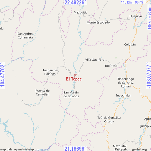
El Tepec GPS coordinates[2]
21° 50' 27.996" North, 103° 46' 26.004" West
| Map corner | latitude | longitude |
|---|---|---|
| Upper-left | 22.49226°, | -104.47702° |
| Center: | 21.84111°, | -103.77389° |
| Lower-right: | 21.18698°, | -103.07077° |
| Map W x H: | 145.1×145.1 km | = 90.2×90.2mi |
| max Lat: | 32.7° ⇑16.8% North |
| El Tepec: | 21.84111° |
| min Lat: | ⇓83.2% South 14.53588° |
| min Long | El Tepec | max Long |
| -117.105° | -103.77389° | -86.73105° |
| W 10.7%⇐ | ⇒89.3% E |
Elevation
Elevation of El Tepec is 889 m = 2917 ft, and this is 364.7 m = 1197 ft below average elevation for this country.
| Max E: |
3497 m = 11473 ft | 61.8% |
| Avg. | 1253.7 m = 4113 ft | |
| El Tepec | 889 m = 2917 ft | |
Min E: |
-1 m = -3 ft | 38.2% |
See also: Mexico elevation on elevation.city.
Geographical zone
El Tepec is located in North Torrid zone (between Equator and Tropic of Cancer). Distance of this Northern Tropic circle is 177.4 km =110.2 mi to North.| Distance of | km | miles | from El Tepec |
|---|---|---|---|
| North Pole | 7578.6 | 4709.1 | to North |
| Arctic Circle | 4972.7 | 3089.9 | to North |
| Tropic Cancer | 177.4 | 110.2 | to North |
| Equator | 2428.5 | 1509 | to South |


Nearby cities:
15 places around El Tepec: (largest is in red/bold)
• Apozolco
47.9 km =29.8 mi,  196°
196°
• Atolinga
32.1 km =19.9 mi,  96°
96°
• Bolaños
1.3 km =0.8 mi,  213°
213°
• Chimaltitán
6.9 km =4.3 mi,  185°
185°
• Florencia
43.9 km =27.3 mi,  148°
148°
• Mesa del Tirador
32.6 km =20.3 mi,  248°
248°
• Momax
48.4 km =30.1 mi,  79°
79°
• Puente de Camotlán
35.3 km =21.9 mi,  243°
243°
• San Martín de Bolaños
18.1 km =11.2 mi, 192°
• Temastián (La Cantera)
29.8 km =18.5 mi,  59°
59°
• Tepizuac
27.8 km =17.3 mi, 149°
• Tlaltenango de Sánchez Román
49.1 km =30.5 mi, 97°
• Totatiche
35.4 km =22 mi,  74°
74°
• Tuxpan de Bolaños
25 km =15.5 mi,  278°
278°
• Villa Guerrero
24.3 km =15.1 mi,  49°
49°
Sources, notices
• [Note1] Compared only with cities in Mexico existing in our database
• [Src1] Map data: © OpenStreetMap contributors (CC-BY-SA)
• [Src2] Other city data from geonames.org with taken over terms of usage.
• [Src3] Geographical zone / Annual Mean Temperature by Robert A. Rohde @ Wikipedia
