Abraham González geodata
Abraham González (Durango) is a populated place; located in Mexico in America/Monterrey (GMT-6) time zone. With population of 880 people, there are 9928 cities with bigger population in this country. Compared to other cities in Mexico, 90.4% of cities are located further ↓South; 91% of cities are located further →East and 66.6% of cities have lower elevation than Abraham González. Note1


Abraham González GPS coordinates[2]
24° 12' 41.796" North, 104° 31' 51.528" West
| Map corner | latitude | longitude |
|---|---|---|
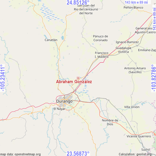
| Upper-left | 24.85126°, | -105.23411° |
| Center: | 24.21161°, | -104.53098° |
| Lower-right: | 23.56873°, | -103.82786° |
| Map W x H: | 142.6×142.6 km | = 88.6×88.6mi |
| max Lat: | 32.7° ⇑9.6% North |
| Abraham González: | 24.21161° |
| min Lat: | ⇓90.4% South 14.53588° |
| min Long | Abraham Gonzál | max Long |
| -117.105° | -104.53098° | -86.73105° |
| W 9%⇐ | ⇒91% E |
Elevation
Elevation of Abraham González is 1862 m = 6109 ft, and this is 608.3 m = 1996 ft above average elevation for this country.
| Max E: |
3497 m = 11473 ft | 33.4% |
| Abraham González | 1862 m 6109 ft | |
| Avg. | 1253.7 m = 4113 ft | |
Min E: |
-1 m = -3 ft | 66.6% |
See also: Mexico elevation on elevation.city.
Geographical zone
Abraham González is located in North temperate zone (between Tropic of Cancer and the Arctic Circle). Distance of this Northern Tropic circle is 86.2 km =53.6 mi to South.| Distance of | km | miles | from Abraham González |
|---|---|---|---|
| North Pole | 7315 | 4545.3 | to North |
| Arctic Circle | 4709.1 | 2926.1 | to North |
| Tropic Cancer | 86.2 | 53.6 | to South |
| Equator | 2692.1 | 1672.8 | to South |


Nearby cities:
15 places around Abraham González: (largest is in red/bold)
• Cinco de Febrero
15.3 km =9.5 mi,  169°
169°
• Cinco de Mayo
13 km =8.1 mi,  199°
199°
• Colonia Anáhuac (Palo Blanco)
23.5 km =14.6 mi,  339°
339°
• Contreras
19.4 km =12.1 mi,  187°
187°
• Dolores Hidalgo
23.7 km =14.7 mi, 190°
• El Arenal
19 km =11.8 mi,  148°
148°
• Hidalgo
8 km =5 mi,  221°
221°
• Juan B. Ceballos
13.7 km =8.5 mi,  267°
267°
• Labor de Guadalupe
8.5 km =5.3 mi,  230°
230°
• Morcillo
17.9 km =11.1 mi,  255°
255°
• Navacoyán
18.2 km =11.3 mi, 185°
• Parras de la Fuente
23.8 km =14.8 mi,  180°
180°
• San Vicente de Chupaderos
21.2 km =13.2 mi,  240°
240°
• Victoria de Durango
24.8 km =15.4 mi,  211°
211°
• Villa Montemorelos
25 km =15.5 mi, 168°
Sources, notices
• [Note1] Compared only with cities in Mexico existing in our database
• [Src1] Map data: © OpenStreetMap contributors (CC-BY-SA)
• [Src2] Other city data from geonames.org with taken over terms of usage.
• [Src3] Geographical zone / Annual Mean Temperature by Robert A. Rohde @ Wikipedia
