San José del Río geodata
San José del Río (Aguascalientes) is a populated place; located in Mexico in America/Mexico_City (GMT-6) time zone. With population of 983 people, there are 8847 cities with bigger population in this country. Compared to other cities in Mexico, 84.9% of cities are located further ↓South; 81.3% of cities are located further →East and 72.8% of cities have lower elevation than San José del Río. Note1


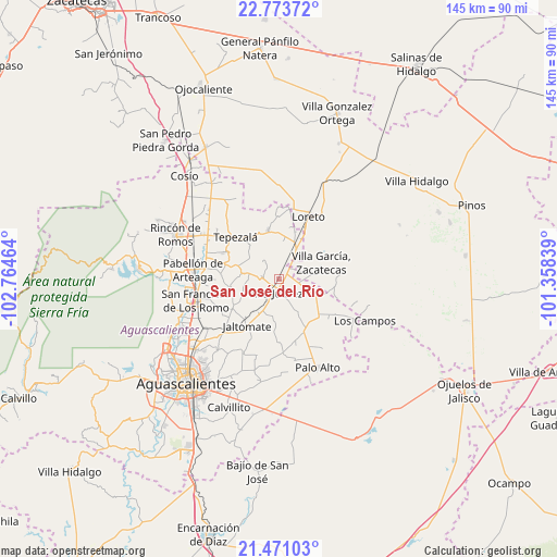
San José del Río GPS coordinates[2]
22° 7' 25.968" North, 102° 3' 41.436" West
| Map corner | latitude | longitude |
|---|---|---|
| Upper-left | 22.77372°, | -102.76464° |
| Center: | 22.12388°, | -102.06151° |
| Lower-right: | 21.47103°, | -101.35839° |
| Map W x H: | 144.8×144.8 km | = 90×90mi |
| max Lat: | 32.7° ⇑15.1% North |
| San José del Río: | 22.12388° |
| min Lat: | ⇓84.9% South 14.53588° |
| min Long | San José del R | max Long |
| -117.105° | -102.06151° | -86.73105° |
| W 18.7%⇐ | ⇒81.3% E |
Elevation
Elevation of San José del Río is 1985 m = 6512 ft, and this is 731.3 m = 2399 ft above average elevation for this country.
| Max E: |
3497 m = 11473 ft | 27.2% |
| San José del Río | 1985 m 6512 ft | |
| Avg. | 1253.7 m = 4113 ft | |
Min E: |
-1 m = -3 ft | 72.8% |
See also: Mexico elevation on elevation.city.
Geographical zone
San José del Río is located in North Torrid zone (between Equator and Tropic of Cancer). Distance of this Northern Tropic circle is 146 km =90.7 mi to North.| Distance of | km | miles | from San José del Río |
|---|---|---|---|
| North Pole | 7547.1 | 4689.5 | to North |
| Arctic Circle | 4941.2 | 3070.3 | to North |
| Tropic Cancer | 146 | 90.7 | to North |
| Equator | 2459.9 | 1528.5 | to South |


Nearby cities:
15 places around San José del Río: (largest is in red/bold)
• Agua Gordita
9.5 km =5.9 mi,  84°
84°
• Ciénega Grande
9 km =5.6 mi,  28°
28°
• Clavellinas
8 km =5 mi,  283°
283°
• El Copetillo
6.6 km =4.1 mi,  70°
70°
• El Polvo
4.9 km =3 mi, 283°
• El Tepozán
9.8 km =6.1 mi,  301°
301°
• El Tule
5.3 km =3.3 mi,  214°
214°
• Jilotepec
9.8 km =6.1 mi,  190°
190°
• Lázaro Cárdenas
6.4 km =4 mi, 33°
• Molinos
5.5 km =3.4 mi,  321°
321°
• Pino Suárez
6.4 km =4 mi, 315°
• Plutarco Elías Calles
10.2 km =6.3 mi,  6°
6°
• Santa María Gallardo
10 km =6.2 mi, 213°
• Villa Juárez
3.4 km =2.1 mi, 193°
• Viudas de Poniente
3.3 km =2.1 mi,  227°
227°
Sources, notices
• [Note1] Compared only with cities in Mexico existing in our database
• [Src1] Map data: © OpenStreetMap contributors (CC-BY-SA)
• [Src2] Other city data from geonames.org with taken over terms of usage.
• [Src3] Geographical zone / Annual Mean Temperature by Robert A. Rohde @ Wikipedia
