El Rodeo geodata
El Rodeo (Guanajuato) is a populated place; located in Mexico in America/Mexico_City (GMT-6) time zone. With population of 720 people, there are 12117 cities with bigger population in this country. Compared to other cities in Mexico, 56.2% of cities are located further ↓South; 70.5% of cities are located further →East and 82.4% of cities have lower elevation than El Rodeo. Note1


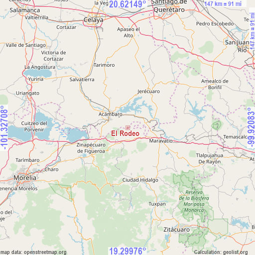
El Rodeo GPS coordinates[2]
19° 57' 43.236" North, 100° 37' 26.22" West
| Map corner | latitude | longitude |
|---|---|---|
| Upper-left | 20.62149°, | -101.32708° |
| Center: | 19.96201°, | -100.62395° |
| Lower-right: | 19.29976°, | -99.92083° |
| Map W x H: | 147×147 km | = 91.3×91.3mi |
| max Lat: | 32.7° ⇑43.8% North |
| El Rodeo: | 19.96201° |
| min Lat: | ⇓56.2% South 14.53588° |
| min Long | El Rodeo | max Long |
| -117.105° | -100.62395° | -86.73105° |
| W 29.5%⇐ | ⇒70.5% E |
Elevation
Elevation of El Rodeo is 2199 m = 7215 ft, and this is 945.3 m = 3101 ft above average elevation for this country.
| Max E: |
3497 m = 11473 ft | 17.6% |
| El Rodeo | 2199 m 7215 ft | |
| Avg. | 1253.7 m = 4113 ft | |
Min E: |
-1 m = -3 ft | 82.4% |
See also: Mexico elevation on elevation.city.
Geographical zone
El Rodeo is located in North Torrid zone (between Equator and Tropic of Cancer). Distance of this Northern Tropic circle is 386.4 km =240.1 mi to North.| Distance of | km | miles | from El Rodeo |
|---|---|---|---|
| North Pole | 7787.5 | 4838.9 | to North |
| Arctic Circle | 5181.6 | 3219.7 | to North |
| Tropic Cancer | 386.4 | 240.1 | to North |
| Equator | 2219.6 | 1379.2 | to South |


Nearby cities:
15 places around El Rodeo: (largest is in red/bold)
• Agua Caliente
10.2 km =6.3 mi,  328°
328°
• Arroyo Colorado
5.2 km =3.2 mi,  1°
1°
• Arroyo de la Luna
7.5 km =4.7 mi,  25°
25°
• Barrio de San Miguel
8.8 km =5.5 mi,  104°
104°
• Buenavista
4.7 km =2.9 mi,  202°
202°
• Heriberto Jara (La Presa)
6.1 km =3.8 mi,  156°
156°
• Huajúmbaro
10.5 km =6.5 mi,  168°
168°
• San Ildefonso
3.9 km =2.4 mi, 172°
• San Miguel
9 km =5.6 mi,  344°
344°
• San Miguel Curinhuato
5.2 km =3.2 mi,  58°
58°
• Santiago Puriatzícuaro
9.5 km =5.9 mi, 157°
• Solís
11.4 km =7.1 mi, 329°
• Tarandacuao
11.8 km =7.3 mi,  68°
68°
• Ucareo
9.6 km =6 mi,  222°
222°
• Uripitio
9 km =5.6 mi, 96°
Sources, notices
• [Note1] Compared only with cities in Mexico existing in our database
• [Src1] Map data: © OpenStreetMap contributors (CC-BY-SA)
• [Src2] Other city data from geonames.org with taken over terms of usage.
• [Src3] Geographical zone / Annual Mean Temperature by Robert A. Rohde @ Wikipedia
