Las Ánimas geodata
Las Ánimas (Guanajuato) is a populated place; located in Mexico in America/Mexico_City (GMT-6) time zone. With population of 1,063 people, there are 8213 cities with bigger population in this country. Compared to other cities in Mexico, 65.6% of cities are located further ↓South; 79.7% of cities are located further →East and 63.1% of cities have lower elevation than Las Ánimas. Note1


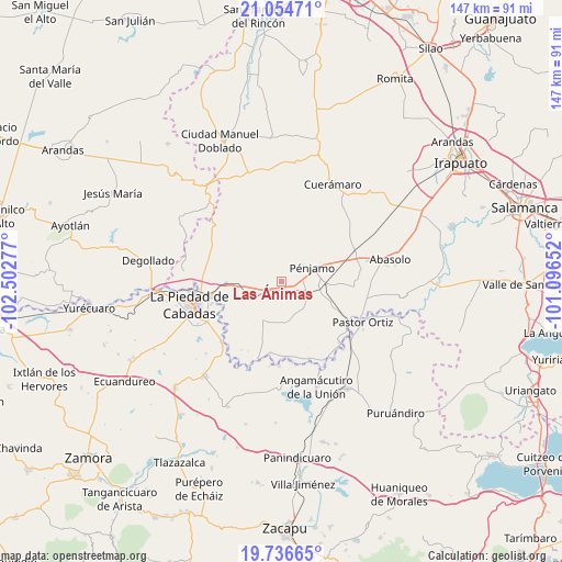
Las Ánimas GPS coordinates[2]
20° 23' 49.524" North, 101° 47' 58.704" West
| Map corner | latitude | longitude |
|---|---|---|
| Upper-left | 21.05471°, | -102.50277° |
| Center: | 20.39709°, | -101.79964° |
| Lower-right: | 19.73665°, | -101.09652° |
| Map W x H: | 146.6×146.6 km | = 91.1×91.1mi |
| max Lat: | 32.7° ⇑34.4% North |
| Las Ánimas: | 20.39709° |
| min Lat: | ⇓65.6% South 14.53588° |
| min Long | Las Ánimas | max Long |
| -117.105° | -101.79964° | -86.73105° |
| W 20.3%⇐ | ⇒79.7% E |
Elevation
Elevation of Las Ánimas is 1780 m = 5840 ft, and this is 526.3 m = 1727 ft above average elevation for this country.
| Max E: |
3497 m = 11473 ft | 36.9% |
| Las Ánimas | 1780 m 5840 ft | |
| Avg. | 1253.7 m = 4113 ft | |
Min E: |
-1 m = -3 ft | 63.1% |
See also: Mexico elevation on elevation.city.
Geographical zone
Las Ánimas is located in North Torrid zone (between Equator and Tropic of Cancer). Distance of this Northern Tropic circle is 338 km =210 mi to North.| Distance of | km | miles | from Las Ánimas |
|---|---|---|---|
| North Pole | 7739.1 | 4808.9 | to North |
| Arctic Circle | 5133.2 | 3189.6 | to North |
| Tropic Cancer | 338 | 210 | to North |
| Equator | 2267.9 | 1409.2 | to South |


Nearby cities:
15 places around Las Ánimas: (largest is in red/bold)
• Aratzipu
7.5 km =4.7 mi,  274°
274°
• Buenavista de Cortés
7.8 km =4.8 mi,  250°
250°
• Churipitzeo
6.2 km =3.9 mi,  74°
74°
• Colorado de Herrera
9.8 km =6.1 mi,  208°
208°
• Colorado de Saavedra
6.8 km =4.2 mi,  132°
132°
• El Pedregal de Arriba
9.7 km =6 mi,  87°
87°
• El Tlacuache
9.9 km =6.2 mi,  138°
138°
• El Volantín
5.6 km =3.5 mi,  19°
19°
• Guangüitiro
5.7 km =3.5 mi,  27°
27°
• Palo Alto de Abajo
3.4 km =2.1 mi,  193°
193°
• Palo Verde
9.7 km =6 mi, 212°
• Pénjamo
8.9 km =5.5 mi,  64°
64°
• San Antonio de Aguirre (San Vicente)
8.6 km =5.3 mi,  116°
116°
• San Bernardo
6.5 km =4 mi,  226°
226°
• Trojes de Paúl
8.9 km =5.5 mi,  159°
159°
Sources, notices
• [Note1] Compared only with cities in Mexico existing in our database
• [Src1] Map data: © OpenStreetMap contributors (CC-BY-SA)
• [Src2] Other city data from geonames.org with taken over terms of usage.
• [Src3] Geographical zone / Annual Mean Temperature by Robert A. Rohde @ Wikipedia
