El Zapote geodata
El Zapote (Guanajuato) is a populated place; located in Mexico in America/Mexico_City (GMT-6) time zone. With population of 578 people, there are 14828 cities with bigger population in this country. Compared to other cities in Mexico, 66.3% of cities are located further ↓South; 72.9% of cities are located further →East and 75.5% of cities have lower elevation than El Zapote. Note1


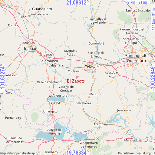
El Zapote GPS coordinates[2]
20° 25' 43.104" North, 100° 55' 46.596" West
| Map corner | latitude | longitude |
|---|---|---|
| Upper-left | 21.08612°, | -101.63274° |
| Center: | 20.42864°, | -100.92961° |
| Lower-right: | 19.76834°, | -100.22649° |
| Map W x H: | 146.5×146.5 km | = 91×91mi |
| max Lat: | 32.7° ⇑33.7% North |
| El Zapote: | 20.42864° |
| min Lat: | ⇓66.3% South 14.53588° |
| min Long | El Zapote | max Long |
| -117.105° | -100.92961° | -86.73105° |
| W 27.1%⇐ | ⇒72.9% E |
Elevation
Elevation of El Zapote is 2039 m = 6690 ft, and this is 785.3 m = 2576 ft above average elevation for this country.
| Max E: |
3497 m = 11473 ft | 24.5% |
| El Zapote | 2039 m 6690 ft | |
| Avg. | 1253.7 m = 4113 ft | |
Min E: |
-1 m = -3 ft | 75.5% |
See also: Mexico elevation on elevation.city.
Geographical zone
El Zapote is located in North Torrid zone (between Equator and Tropic of Cancer). Distance of this Northern Tropic circle is 334.5 km =207.8 mi to North.| Distance of | km | miles | from El Zapote |
|---|---|---|---|
| North Pole | 7735.6 | 4806.7 | to North |
| Arctic Circle | 5129.7 | 3187.4 | to North |
| Tropic Cancer | 334.5 | 207.8 | to North |
| Equator | 2271.5 | 1411.4 | to South |


Nearby cities:
15 places around El Zapote: (largest is in red/bold)
• Arreguín de Arriba
9.8 km =6.1 mi,  98°
98°
• Cañada de Caracheo
6.1 km =3.8 mi,  195°
195°
• Colonia la Calzada (La Olla)
8.8 km =5.5 mi,  339°
339°
• Cortazar
7 km =4.3 mi,  330°
330°
• De Parral
8.7 km =5.4 mi,  290°
290°
• El Diezmo
9 km =5.6 mi,  270°
270°
• El Huizache
3.3 km =2.1 mi,  251°
251°
• La Gavia
6.3 km =3.9 mi,  127°
127°
• La Huerta
5.8 km =3.6 mi,  357°
357°
• La Mocha
7.6 km =4.7 mi, 250°
• La Palmita (La Palmita de San Gabriel)
9.4 km =5.8 mi,  34°
34°
• Merino
8.7 km =5.4 mi, 33°
• San Nicolás de Manantiales
5.1 km =3.2 mi,  225°
225°
• Santa Fe de la Purísima
8.4 km =5.2 mi, 27°
• Valencia de Fuentes
4.2 km =2.6 mi, 294°
Sources, notices
• [Note1] Compared only with cities in Mexico existing in our database
• [Src1] Map data: © OpenStreetMap contributors (CC-BY-SA)
• [Src2] Other city data from geonames.org with taken over terms of usage.
• [Src3] Geographical zone / Annual Mean Temperature by Robert A. Rohde @ Wikipedia
