La Cantera geodata
La Cantera (Guanajuato) is a populated place; located in Mexico in America/Mexico_City (GMT-6) time zone. With population of 617 people, there are 13976 cities with bigger population in this country. Compared to other cities in Mexico, 75.2% of cities are located further ↓South; 74% of cities are located further →East and 77.9% of cities have lower elevation than La Cantera. Note1
Administrative division(s):
- Level 1: Guanajuato
- Level 2: Dolores Hidalgo Cuna de la Independencia Nacional


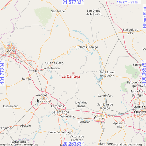
La Cantera GPS coordinates[2]
20° 55' 19.272" North, 101° 4' 8.076" West
| Map corner | latitude | longitude |
|---|---|---|
| Upper-left | 21.57733°, | -101.77204° |
| Center: | 20.92202°, | -101.06891° |
| Lower-right: | 20.26383°, | -100.36579° |
| Map W x H: | 146×146.1 km | = 90.7×90.8mi |
| max Lat: | 32.7° ⇑24.8% North |
| La Cantera: | 20.92202° |
| min Lat: | ⇓75.2% South 14.53588° |
| min Long | La Cantera | max Long |
| -117.105° | -101.06891° | -86.73105° |
| W 26%⇐ | ⇒74% E |
Elevation
Elevation of La Cantera is 2086 m = 6844 ft, and this is 832.3 m = 2731 ft above average elevation for this country.
| Max E: |
3497 m = 11473 ft | 22.1% |
| La Cantera | 2086 m 6844 ft | |
| Avg. | 1253.7 m = 4113 ft | |
Min E: |
-1 m = -3 ft | 77.9% |
See also: Mexico elevation on elevation.city.
Geographical zone
La Cantera is located in North Torrid zone (between Equator and Tropic of Cancer). Distance of this Northern Tropic circle is 279.6 km =173.7 mi to North.| Distance of | km | miles | from La Cantera |
|---|---|---|---|
| North Pole | 7680.8 | 4772.6 | to North |
| Arctic Circle | 5074.9 | 3153.4 | to North |
| Tropic Cancer | 279.6 | 173.7 | to North |
| Equator | 2326.3 | 1445.5 | to South |


Nearby cities:
15 places around La Cantera: (largest is in red/bold)
• Calderones
17.9 km =11.1 mi,  294°
294°
• Campuzano
7.5 km =4.7 mi,  264°
264°
• Don Francisco
15.7 km =9.8 mi,  97°
97°
• El Tejabán
17.1 km =10.6 mi, 258°
• La Sauceda
13 km =8.1 mi, 258°
• La Trinidad
19.3 km =12 mi,  266°
266°
• Mesas de Acosta
19.3 km =12 mi,  182°
182°
• San Damián
11.8 km =7.3 mi,  80°
80°
• San José de Allende
8.1 km =5 mi,  152°
152°
• San José del Rodeo
15.3 km =9.5 mi, 269°
• San Lucas
13.9 km =8.6 mi,  94°
94°
• San Marcos de Abajo
12.3 km =7.6 mi,  26°
26°
• San Martín de Terreros
4.6 km =2.9 mi, 104°
• Santa Bárbara
15.4 km =9.6 mi,  23°
23°
• Xoconoxtle el Grande
9.3 km =5.8 mi, 78°
Sources, notices
• [Note1] Compared only with cities in Mexico existing in our database
• [Src1] Map data: © OpenStreetMap contributors (CC-BY-SA)
• [Src2] Other city data from geonames.org with taken over terms of usage.
• [Src3] Geographical zone / Annual Mean Temperature by Robert A. Rohde @ Wikipedia
