San José de Allende geodata
San José de Allende (Guanajuato) is a populated place; located in Mexico in America/Mexico_City (GMT-6) time zone. With population of 899 people, there are 9699 cities with bigger population in this country. Compared to other cities in Mexico, 74% of cities are located further ↓South; 73.7% of cities are located further →East and 79.4% of cities have lower elevation than San José de Allende. Note1


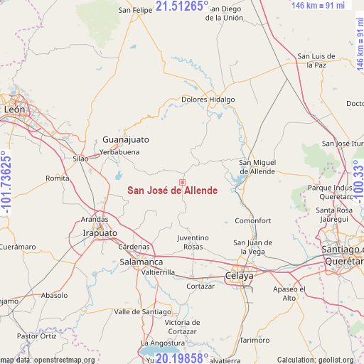
San José de Allende GPS coordinates[2]
20° 51' 25.38" North, 101° 1' 59.232" West
| Map corner | latitude | longitude |
|---|---|---|
| Upper-left | 21.51265°, | -101.73625° |
| Center: | 20.85705°, | -101.03312° |
| Lower-right: | 20.19858°, | -100.33° |
| Map W x H: | 146.1×146.1 km | = 90.8×90.8mi |
| max Lat: | 32.7° ⇑26% North |
| San José de Allende: | 20.85705° |
| min Lat: | ⇓74% South 14.53588° |
| min Long | San José de Al | max Long |
| -117.105° | -101.03312° | -86.73105° |
| W 26.3%⇐ | ⇒73.7% E |
Elevation
Elevation of San José de Allende is 2126 m = 6975 ft, and this is 872.3 m = 2862 ft above average elevation for this country.
| Max E: |
3497 m = 11473 ft | 20.6% |
| San José de Allende | 2126 m 6975 ft | |
| Avg. | 1253.7 m = 4113 ft | |
Min E: |
-1 m = -3 ft | 79.4% |
See also: Mexico elevation on elevation.city.
Geographical zone
San José de Allende is located in North Torrid zone (between Equator and Tropic of Cancer). Distance of this Northern Tropic circle is 286.8 km =178.2 mi to North.| Distance of | km | miles | from San José de Allende |
|---|---|---|---|
| North Pole | 7688 | 4777.1 | to North |
| Arctic Circle | 5082.1 | 3157.9 | to North |
| Tropic Cancer | 286.8 | 178.2 | to North |
| Equator | 2319.1 | 1441 | to South |


Nearby cities:
15 places around San José de Allende: (largest is in red/bold)
• Campuzano
12.9 km =8 mi,  300°
300°
• Don Francisco
12.9 km =8 mi,  66°
66°
• El Naranjillo
16.2 km =10.1 mi,  167°
167°
• La Cantera
8.1 km =5 mi,  332°
332°
• La Sauceda
17.1 km =10.6 mi,  285°
285°
• Landín
17.5 km =10.9 mi,  130°
130°
• Mesas de Acosta
12.8 km =8 mi,  200°
200°
• Ojo de Agua de García
12.5 km =7.8 mi, 126°
• Pocitos de Corrales
17.8 km =11.1 mi,  148°
148°
• San Antonio de Corrales
14.3 km =8.9 mi, 149°
• San Damián
12.1 km =7.5 mi,  41°
41°
• San Diego de los Dolores
14.6 km =9.1 mi,  178°
178°
• San Lucas
11.8 km =7.3 mi,  58°
58°
• San Martín de Terreros
6.1 km =3.8 mi,  6°
6°
• Xoconoxtle el Grande
10.5 km =6.5 mi,  30°
30°
Sources, notices
• [Note1] Compared only with cities in Mexico existing in our database
• [Src1] Map data: © OpenStreetMap contributors (CC-BY-SA)
• [Src2] Other city data from geonames.org with taken over terms of usage.
• [Src3] Geographical zone / Annual Mean Temperature by Robert A. Rohde @ Wikipedia
