Venta de Bravo geodata
Venta de Bravo (State of Mexico) is a populated place; located in Mexico in America/Mexico_City (GMT-6) time zone. With population of 1,576 people, there are 5480 cities with bigger population in this country. Compared to other cities in Mexico, 54.3% of cities are located further ↓South; 66.2% of cities are located further →East and 86.5% of cities have lower elevation than Venta de Bravo. Note1


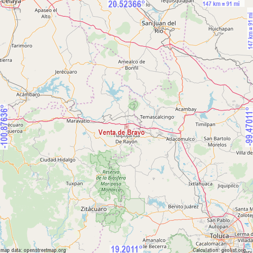
Venta de Bravo GPS coordinates[2]
19° 51' 49.536" North, 100° 10' 23.628" West
| Map corner | latitude | longitude |
|---|---|---|
| Upper-left | 20.52366°, | -100.87636° |
| Center: | 19.86376°, | -100.17323° |
| Lower-right: | 19.2011°, | -99.47011° |
| Map W x H: | 147.1×147.1 km | = 91.4×91.4mi |
| max Lat: | 32.7° ⇑45.7% North |
| Venta de Bravo: | 19.86376° |
| min Lat: | ⇓54.3% South 14.53588° |
| min Long | Venta de Bravo | max Long |
| -117.105° | -100.17323° | -86.73105° |
| W 33.8%⇐ | ⇒66.2% E |
Elevation
Elevation of Venta de Bravo is 2296 m = 7533 ft, and this is 1042.3 m = 3420 ft above average elevation for this country.
| Max E: |
3497 m = 11473 ft | 13.5% |
| Venta de Bravo | 2296 m 7533 ft | |
| Avg. | 1253.7 m = 4113 ft | |
Min E: |
-1 m = -3 ft | 86.5% |
See also: Mexico elevation on elevation.city.
Geographical zone
Venta de Bravo is located in North Torrid zone (between Equator and Tropic of Cancer). Distance of this Northern Tropic circle is 397.3 km =246.9 mi to North.| Distance of | km | miles | from Venta de Bravo |
|---|---|---|---|
| North Pole | 7798.4 | 4845.7 | to North |
| Arctic Circle | 5192.5 | 3226.5 | to North |
| Tropic Cancer | 397.3 | 246.9 | to North |
| Equator | 2208.6 | 1372.4 | to South |


Nearby cities:
15 places around Venta de Bravo: (largest is in red/bold)
• Agua Caliente
4 km =2.5 mi,  2°
2°
• Barrio la Estrellita
7.4 km =4.6 mi,  140°
140°
• Buenavista
8.1 km =5 mi,  312°
312°
• El Capulín
2.7 km =1.7 mi,  57°
57°
• El Césped
4.1 km =2.5 mi, 59°
• El Encino
5.4 km =3.4 mi, 4°
• El Gigante
2.7 km =1.7 mi,  235°
235°
• El Oro de Hidalgo
8.1 km =5 mi,  146°
146°
• Las Tenerías (Las Tenerías de Tepetongo)
6.9 km =4.3 mi,  48°
48°
• Los Remedios
7.4 km =4.6 mi,  198°
198°
• Monte Alegre
7.9 km =4.9 mi,  209°
209°
• Sandía
6.4 km =4 mi, 213°
• Tepetongo
6.5 km =4 mi,  39°
39°
• Tlalpujahua de Rayón
6.5 km =4 mi,  180°
180°
• Zaragoza (Puerto de Medina)
5.9 km =3.7 mi,  79°
79°
Sources, notices
• [Note1] Compared only with cities in Mexico existing in our database
• [Src1] Map data: © OpenStreetMap contributors (CC-BY-SA)
• [Src2] Other city data from geonames.org with taken over terms of usage.
• [Src3] Geographical zone / Annual Mean Temperature by Robert A. Rohde @ Wikipedia
