San Gregorio geodata
San Gregorio (Michoacán) is a populated place; located in Mexico in America/Mexico_City (GMT-6) time zone. With population of 1,180 people, there are 7362 cities with bigger population in this country. Compared to other cities in Mexico, 56.2% of cities are located further ↑North; 77.7% of cities are located further →East and 97.1% of cities have lower elevation than San Gregorio. Note1


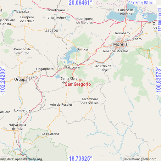
San Gregorio GPS coordinates[2]
19° 24' 10.008" North, 101° 32' 20.04" West
| Map corner | latitude | longitude |
|---|---|---|
| Upper-left | 20.06461°, | -102.24203° |
| Center: | 19.40278°, | -101.5389° |
| Lower-right: | 18.73825°, | -100.83578° |
| Map W x H: | 147.5×147.5 km | = 91.7×91.7mi |
| max Lat: | 32.7° ⇑56.2% North |
| San Gregorio: | 19.40278° |
| min Lat: | ⇓43.8% South 14.53588° |
| min Long | San Gregorio | max Long |
| -117.105° | -101.5389° | -86.73105° |
| W 22.3%⇐ | ⇒77.7% E |
Elevation
Elevation of San Gregorio is 2684 m = 8806 ft, and this is 1430.3 m = 4693 ft above average elevation for this country.
| Max E: |
3497 m = 11473 ft | 2.9% |
| San Gregorio | 2684 m 8806 ft | |
| Avg. | 1253.7 m = 4113 ft | |
Min E: |
-1 m = -3 ft | 97.1% |
See also: Mexico elevation on elevation.city.
Geographical zone
San Gregorio is located in North Torrid zone (between Equator and Tropic of Cancer). Distance of this Northern Tropic circle is 448.5 km =278.7 mi to North.| Distance of | km | miles | from San Gregorio |
|---|---|---|---|
| North Pole | 7849.7 | 4877.6 | to North |
| Arctic Circle | 5243.8 | 3258.3 | to North |
| Tropic Cancer | 448.5 | 278.7 | to North |
| Equator | 2157.4 | 1340.5 | to South |


Nearby cities:
15 places around San Gregorio: (largest is in red/bold)
• Canacucho
9.9 km =6.2 mi,  29°
29°
• Chapa
13.5 km =8.4 mi,  259°
259°
• Colonia Vista Bella (Lomas del Peaje)
11.4 km =7.1 mi,  329°
329°
• Cuanajo
9.7 km =6 mi,  19°
19°
• Cuitzitán
12.5 km =7.8 mi,  248°
248°
• El Refugio
9.1 km =5.7 mi, 33°
• El Tepetate
5.6 km =3.5 mi,  233°
233°
• Joya de los Molinos
11.8 km =7.3 mi, 326°
• Opopeo
7 km =4.3 mi,  278°
278°
• San José de los Laureles
11 km =6.8 mi,  131°
131°
• San Juan de Viña
9.1 km =5.7 mi,  135°
135°
• Santa Clara del Cobre
10.6 km =6.6 mi,  271°
271°
• Santa Juana
3.8 km =2.4 mi,  322°
322°
• Tupátaro
12.1 km =7.5 mi, 23°
• Turirán
8.3 km =5.2 mi, 230°
Sources, notices
• [Note1] Compared only with cities in Mexico existing in our database
• [Src1] Map data: © OpenStreetMap contributors (CC-BY-SA)
• [Src2] Other city data from geonames.org with taken over terms of usage.
• [Src3] Geographical zone / Annual Mean Temperature by Robert A. Rohde @ Wikipedia
