El Tepetate geodata
El Tepetate (Michoacán) is a populated place; located in Mexico in America/Mexico_City (GMT-6) time zone. With population of 560 people, there are 15231 cities with bigger population in this country. Compared to other cities in Mexico, 57% of cities are located further ↑North; 78% of cities are located further →East and 92.3% of cities have lower elevation than El Tepetate. Note1


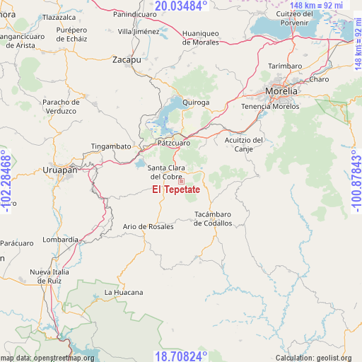
El Tepetate GPS coordinates[2]
19° 22' 22.404" North, 101° 34' 53.58" West
| Map corner | latitude | longitude |
|---|---|---|
| Upper-left | 20.03484°, | -102.28468° |
| Center: | 19.37289°, | -101.58155° |
| Lower-right: | 18.70824°, | -100.87843° |
| Map W x H: | 147.5×147.5 km | = 91.7×91.7mi |
| max Lat: | 32.7° ⇑57% North |
| El Tepetate: | 19.37289° |
| min Lat: | ⇓43% South 14.53588° |
| min Long | El Tepetate | max Long |
| -117.105° | -101.58155° | -86.73105° |
| W 22%⇐ | ⇒78% E |
Elevation
Elevation of El Tepetate is 2498 m = 8196 ft, and this is 1244.3 m = 4082 ft above average elevation for this country.
| Max E: |
3497 m = 11473 ft | 7.7% |
| El Tepetate | 2498 m 8196 ft | |
| Avg. | 1253.7 m = 4113 ft | |
Min E: |
-1 m = -3 ft | 92.3% |
See also: Mexico elevation on elevation.city.
Geographical zone
El Tepetate is located in North Torrid zone (between Equator and Tropic of Cancer). Distance of this Northern Tropic circle is 451.9 km =280.8 mi to North.| Distance of | km | miles | from El Tepetate |
|---|---|---|---|
| North Pole | 7853 | 4879.6 | to North |
| Arctic Circle | 5247.1 | 3260.4 | to North |
| Tropic Cancer | 451.9 | 280.8 | to North |
| Equator | 2154.1 | 1338.5 | to South |


Nearby cities:
15 places around El Tepetate: (largest is in red/bold)
• Camémbaro
9.4 km =5.8 mi,  232°
232°
• Chapa
8.8 km =5.5 mi,  274°
274°
• Colonia Vista Bella (Lomas del Peaje)
13.2 km =8.2 mi,  354°
354°
• Cuitzitán
7.3 km =4.5 mi,  260°
260°
• Joya de los Molinos
13.3 km =8.3 mi, 350°
• Opopeo
5 km =3.1 mi,  330°
330°
• Parahuén
11.8 km =7.3 mi, 258°
• San Gregorio
5.6 km =3.5 mi,  53°
53°
• San José de los Laureles
13.3 km =8.3 mi,  107°
107°
• San Juan de Viña
11.3 km =7 mi, 106°
• Santa Clara del Cobre
7.1 km =4.4 mi,  300°
300°
• Santa Juana
6.7 km =4.2 mi,  18°
18°
• Santas Marías
14.2 km =8.8 mi,  155°
155°
• Serrano
13.2 km =8.2 mi,  143°
143°
• Turirán
2.8 km =1.7 mi,  223°
223°
Sources, notices
• [Note1] Compared only with cities in Mexico existing in our database
• [Src1] Map data: © OpenStreetMap contributors (CC-BY-SA)
• [Src2] Other city data from geonames.org with taken over terms of usage.
• [Src3] Geographical zone / Annual Mean Temperature by Robert A. Rohde @ Wikipedia
