Canacucho geodata
Canacucho (Michoacán) is a populated place; located in Mexico in America/Mexico_City (GMT-6) time zone. With population of 530 people, there are 15970 cities with bigger population in this country. Compared to other cities in Mexico, 54.5% of cities are located further ↑North; 77.4% of cities are located further →East and 88.1% of cities have lower elevation than Canacucho. Note1


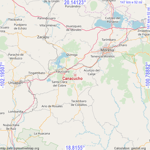
Canacucho GPS coordinates[2]
19° 28' 46.992" North, 101° 29' 30.984" West
| Map corner | latitude | longitude |
|---|---|---|
| Upper-left | 20.14123°, | -102.19507° |
| Center: | 19.47972°, | -101.49194° |
| Lower-right: | 18.8155°, | -100.78882° |
| Map W x H: | 147.4×147.4 km | = 91.6×91.6mi |
| max Lat: | 32.7° ⇑54.5% North |
| Canacucho: | 19.47972° |
| min Lat: | ⇓45.5% South 14.53588° |
| min Long | Canacucho | max Long |
| -117.105° | -101.49194° | -86.73105° |
| W 22.6%⇐ | ⇒77.4% E |
Elevation
Elevation of Canacucho is 2344 m = 7690 ft, and this is 1090.3 m = 3577 ft above average elevation for this country.
| Max E: |
3497 m = 11473 ft | 11.9% |
| Canacucho | 2344 m 7690 ft | |
| Avg. | 1253.7 m = 4113 ft | |
Min E: |
-1 m = -3 ft | 88.1% |
See also: Mexico elevation on elevation.city.
Geographical zone
Canacucho is located in North Torrid zone (between Equator and Tropic of Cancer). Distance of this Northern Tropic circle is 440 km =273.4 mi to North.| Distance of | km | miles | from Canacucho |
|---|---|---|---|
| North Pole | 7841.1 | 4872.2 | to North |
| Arctic Circle | 5235.2 | 3253 | to North |
| Tropic Cancer | 440 | 273.4 | to North |
| Equator | 2165.9 | 1345.8 | to South |


Nearby cities:
15 places around Canacucho: (largest is in red/bold)
• Chihuerio
10.2 km =6.3 mi,  87°
87°
• Colonia Vista Bella (Lomas del Peaje)
10.8 km =6.7 mi,  276°
276°
• Cuanajo
1.8 km =1.1 mi,  288°
288°
• El Pedregal
5.7 km =3.5 mi,  52°
52°
• El Refugio
1 km =0.6 mi,  173°
173°
• El Sobrado
4.9 km =3 mi,  38°
38°
• Fontezuelas
12.3 km =7.6 mi,  19°
19°
• Huiramba
9.4 km =5.8 mi, 38°
• Joya de los Molinos
11.6 km =7.2 mi, 276°
• Lagunillas
12.2 km =7.6 mi, 40°
• Las Tablas
5.8 km =3.6 mi,  65°
65°
• San Andrés Coapa
11.6 km =7.2 mi,  79°
79°
• San Gregorio
9.9 km =6.2 mi,  209°
209°
• Santa Juana
9.1 km =5.7 mi,  232°
232°
• Tupátaro
2.5 km =1.6 mi,  359°
359°
Sources, notices
• [Note1] Compared only with cities in Mexico existing in our database
• [Src1] Map data: © OpenStreetMap contributors (CC-BY-SA)
• [Src2] Other city data from geonames.org with taken over terms of usage.
• [Src3] Geographical zone / Annual Mean Temperature by Robert A. Rohde @ Wikipedia
