Santa Juana geodata
Santa Juana (Michoacán) is a populated place; located in Mexico in America/Mexico_City (GMT-6) time zone. With population of 1,956 people, there are 4451 cities with bigger population in this country. Compared to other cities in Mexico, 55.5% of cities are located further ↑North; 77.9% of cities are located further →East and 92% of cities have lower elevation than Santa Juana. Note1


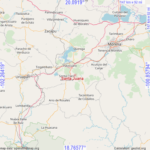
Santa Juana GPS coordinates[2]
19° 25' 48.684" North, 101° 33' 39.816" West
| Map corner | latitude | longitude |
|---|---|---|
| Upper-left | 20.0919°, | -102.26419° |
| Center: | 19.43019°, | -101.56106° |
| Lower-right: | 18.76577°, | -100.85794° |
| Map W x H: | 147.5×147.5 km | = 91.7×91.7mi |
| max Lat: | 32.7° ⇑55.5% North |
| Santa Juana: | 19.43019° |
| min Lat: | ⇓44.5% South 14.53588° |
| min Long | Santa Juana | max Long |
| -117.105° | -101.56106° | -86.73105° |
| W 22.1%⇐ | ⇒77.9% E |
Elevation
Elevation of Santa Juana is 2485 m = 8153 ft, and this is 1231.3 m = 4040 ft above average elevation for this country.
| Max E: |
3497 m = 11473 ft | 8% |
| Santa Juana | 2485 m 8153 ft | |
| Avg. | 1253.7 m = 4113 ft | |
Min E: |
-1 m = -3 ft | 92% |
See also: Mexico elevation on elevation.city.
Geographical zone
Santa Juana is located in North Torrid zone (between Equator and Tropic of Cancer). Distance of this Northern Tropic circle is 445.5 km =276.8 mi to North.| Distance of | km | miles | from Santa Juana |
|---|---|---|---|
| North Pole | 7846.6 | 4875.6 | to North |
| Arctic Circle | 5240.7 | 3256.4 | to North |
| Tropic Cancer | 445.5 | 276.8 | to North |
| Equator | 2160.4 | 1342.4 | to South |


Nearby cities:
15 places around Santa Juana: (largest is in red/bold)
• Canacucho
9.1 km =5.7 mi,  52°
52°
• Chapa
12.3 km =7.6 mi,  242°
242°
• Colonia Vista Bella (Lomas del Peaje)
7.6 km =4.7 mi,  332°
332°
• Cuanajo
8.2 km =5.1 mi,  42°
42°
• Cuitzitán
12 km =7.5 mi,  230°
230°
• El Refugio
8.6 km =5.3 mi,  58°
58°
• El Tepetate
6.7 km =4.2 mi,  198°
198°
• Joya de los Molinos
8 km =5 mi, 327°
• Opopeo
5.1 km =3.2 mi,  245°
245°
• Pátzcuaro
10.8 km =6.7 mi, 332°
• San Gregorio
3.8 km =2.4 mi,  142°
142°
• San Juan de Viña
12.9 km =8 mi, 137°
• Santa Clara del Cobre
8.7 km =5.4 mi, 251°
• Tupátaro
10.8 km =6.7 mi, 41°
• Turirán
9.3 km =5.8 mi,  205°
205°
Sources, notices
• [Note1] Compared only with cities in Mexico existing in our database
• [Src1] Map data: © OpenStreetMap contributors (CC-BY-SA)
• [Src2] Other city data from geonames.org with taken over terms of usage.
• [Src3] Geographical zone / Annual Mean Temperature by Robert A. Rohde @ Wikipedia
