San José Guadalupe Otzacatipan geodata
San José Guadalupe Otzacatipan (State of Mexico) is a populated place; located in Mexico in America/Mexico_City (GMT-6) time zone. With population of 31,299 people, there are 322 cities with bigger population in this country. Compared to other cities in Mexico, 57.7% of cities are located further ↑North; 58.4% of cities are located further →East and 94.8% of cities have lower elevation than San José Guadalupe Otzacatipan. Note1
Current local time in San José Guadalupe Otzacatipan:
02:43 AM, WednesdayDifference from your time zone: hours


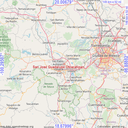
San José Guadalupe Otzacatipan GPS coordinates[2]
19° 20' 40.992" North, 99° 35' 30.984" West
| Map corner | latitude | longitude |
|---|---|---|
| Upper-left | 20.00679°, | -100.29507° |
| Center: | 19.34472°, | -99.59194° |
| Lower-right: | 18.67996°, | -98.88882° |
| Map W x H: | 147.5×147.5 km | = 91.7×91.7mi |
| max Lat: | 32.7° ⇑57.7% North |
| San José Guadalupe Otzacatipan: | 19.34472° |
| min Lat: | ⇓42.3% South 14.53588° |
| min Long | San José Guada | max Long |
| -117.105° | -99.59194° | -86.73105° |
| W 41.6%⇐ | ⇒58.4% E |
Elevation
Elevation of San José Guadalupe Otzacatipan is 2591 m = 8501 ft, and this is 1337.3 m = 4387 ft above average elevation for this country.
| Max E: |
3497 m = 11473 ft | 5.2% |
| San José Guadalupe Otzacatipan | 2591 m 8501 ft | |
| Avg. | 1253.7 m = 4113 ft | |
Min E: |
-1 m = -3 ft | 94.8% |
See also: Mexico elevation on elevation.city.
Geographical zone
San José Guadalupe Otzacatipan is located in North Torrid zone (between Equator and Tropic of Cancer). Distance of this Northern Tropic circle is 455 km =282.7 mi to North.| Distance of | km | miles | from San José Guadalupe Otzacatipan |
|---|---|---|---|
| North Pole | 7856.1 | 4881.6 | to North |
| Arctic Circle | 5250.2 | 3262.3 | to North |
| Tropic Cancer | 455 | 282.7 | to North |
| Equator | 2150.9 | 1336.5 | to South |


Nearby cities:
15 places around San José Guadalupe Otzacatipan: (largest is in red/bold)
• El Cerrillo Vista Hermosa
5.7 km =3.5 mi,  114°
114°
• Guadalupe Totoltepec
2.9 km =1.8 mi,  82°
82°
• Jicaltepec Cuexcontitlán
4.9 km =3 mi,  310°
310°
• La Constitución Toltepec
4.5 km =2.8 mi, 84°
• La Joya
5.6 km =3.5 mi,  17°
17°
• La Y
5.9 km =3.7 mi,  2°
2°
• San Andrés Cuexcontitlán
3.5 km =2.2 mi,  296°
296°
• San Blas Otzacatipan
4.6 km =2.9 mi,  35°
35°
• San Diego los Padres Cuexcontitlán Sección 5 B
4.1 km =2.5 mi,  328°
328°
• San Francisco Totoltepec
4.2 km =2.6 mi, 114°
• San Mateo Otzacatipan
1.8 km =1.1 mi,  222°
222°
• San Miguel Totoltepec
2.7 km =1.7 mi,  147°
147°
• San Nicolás Tolentino
2.6 km =1.6 mi,  53°
53°
• San Pedro Totoltepec
4.3 km =2.7 mi, 150°
• Santa María Totoltepec
4.2 km =2.6 mi,  181°
181°
Sources, notices
• [Note1] Compared only with cities in Mexico existing in our database
• [Src1] Map data: © OpenStreetMap contributors (CC-BY-SA)
• [Src2] Other city data from geonames.org with taken over terms of usage.
• [Src3] Geographical zone / Annual Mean Temperature by Robert A. Rohde @ Wikipedia
