San Miguel Totoltepec geodata
San Miguel Totoltepec (Morelos) is a populated place; located in Mexico in America/Mexico_City (GMT-6) time zone. With population of 5,471 people, there are 1700 cities with bigger population in this country. Compared to other cities in Mexico, 58.3% of cities are located further ↑North; 58.1% of cities are located further →East and 94.8% of cities have lower elevation than San Miguel Totoltepec. Note1
Current local time in San Miguel Totoltepec:
02:37 AM, WednesdayDifference from your time zone: hours


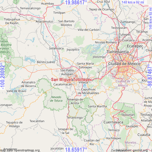
San Miguel Totoltepec GPS coordinates[2]
19° 19' 26.472" North, 99° 34' 40.044" West
| Map corner | latitude | longitude |
|---|---|---|
| Upper-left | 19.98617°, | -100.28092° |
| Center: | 19.32402°, | -99.57779° |
| Lower-right: | 18.65917°, | -98.87467° |
| Map W x H: | 147.5×147.6 km | = 91.7×91.7mi |
| max Lat: | 32.7° ⇑58.3% North |
| San Miguel Totoltepec: | 19.32402° |
| min Lat: | ⇓41.7% South 14.53588° |
| min Long | San Miguel Toto | max Long |
| -117.105° | -99.57779° | -86.73105° |
| W 41.9%⇐ | ⇒58.1% E |
Elevation
Elevation of San Miguel Totoltepec is 2591 m = 8501 ft, and this is 1337.3 m = 4387 ft above average elevation for this country.
| Max E: |
3497 m = 11473 ft | 5.2% |
| San Miguel Totoltepec | 2591 m 8501 ft | |
| Avg. | 1253.7 m = 4113 ft | |
Min E: |
-1 m = -3 ft | 94.8% |
See also: Mexico elevation on elevation.city.
Geographical zone
San Miguel Totoltepec is located in North Torrid zone (between Equator and Tropic of Cancer). Distance of this Northern Tropic circle is 457.3 km =284.2 mi to North.| Distance of | km | miles | from San Miguel Totoltepec |
|---|---|---|---|
| North Pole | 7858.4 | 4883 | to North |
| Arctic Circle | 5252.5 | 3263.8 | to North |
| Tropic Cancer | 457.3 | 284.2 | to North |
| Equator | 2148.6 | 1335.1 | to South |


Nearby cities:
15 places around San Miguel Totoltepec: (largest is in red/bold)
• Arroyo Vista Hermosa
4.4 km =2.7 mi,  79°
79°
• Colonia Isidro Fabela
6.3 km =3.9 mi,  114°
114°
• Colonia los Cedros
4.1 km =2.5 mi, 109°
• El Cerrillo Vista Hermosa
3.7 km =2.3 mi,  91°
91°
• Guadalupe Totoltepec
3.1 km =1.9 mi,  27°
27°
• La Constitución Toltepec
4.1 km =2.5 mi,  47°
47°
• San Andrés Cuexcontitlán
6 km =3.7 mi,  310°
310°
• San Blas Otzacatipan
6.2 km =3.9 mi,  11°
11°
• San Francisco Totoltepec
2.4 km =1.5 mi, 77°
• San Jerónimo Chicahualco
4.9 km =3 mi,  199°
199°
• San José Guadalupe Otzacatipan
2.7 km =1.7 mi,  327°
327°
• San Mateo Otzacatipan
2.9 km =1.8 mi,  289°
289°
• San Nicolás Tolentino
3.9 km =2.4 mi, 9°
• San Pedro Totoltepec
1.6 km =1 mi,  157°
157°
• Santa María Totoltepec
2.5 km =1.6 mi,  218°
218°
Sources, notices
• [Note1] Compared only with cities in Mexico existing in our database
• [Src1] Map data: © OpenStreetMap contributors (CC-BY-SA)
• [Src2] Other city data from geonames.org with taken over terms of usage.
• [Src3] Geographical zone / Annual Mean Temperature by Robert A. Rohde @ Wikipedia
