San Mateo Otzacatipan geodata
San Mateo Otzacatipan (Morelos) is a populated place; located in Mexico in America/Mexico_City (GMT-6) time zone. With population of 22,656 people, there are 456 cities with bigger population in this country. Compared to other cities in Mexico, 58% of cities are located further ↑North; 58.6% of cities are located further →East and 95.3% of cities have lower elevation than San Mateo Otzacatipan. Note1


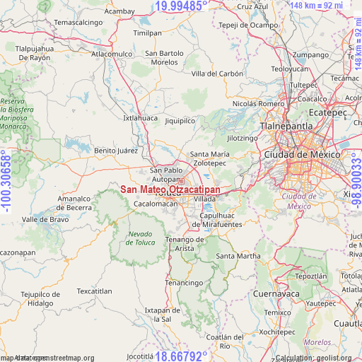
San Mateo Otzacatipan GPS coordinates[2]
19° 19' 57.828" North, 99° 36' 12.42" West
| Map corner | latitude | longitude |
|---|---|---|
| Upper-left | 19.99485°, | -100.30658° |
| Center: | 19.33273°, | -99.60345° |
| Lower-right: | 18.66792°, | -98.90033° |
| Map W x H: | 147.5×147.5 km | = 91.7×91.7mi |
| max Lat: | 32.7° ⇑58% North |
| San Mateo Otzacatipan: | 19.33273° |
| min Lat: | ⇓42% South 14.53588° |
| min Long | San Mateo Otzac | max Long |
| -117.105° | -99.60345° | -86.73105° |
| W 41.4%⇐ | ⇒58.6% E |
Elevation
Elevation of San Mateo Otzacatipan is 2603 m = 8540 ft, and this is 1349.3 m = 4427 ft above average elevation for this country.
| Max E: |
3497 m = 11473 ft | 4.7% |
| San Mateo Otzacatipan | 2603 m 8540 ft | |
| Avg. | 1253.7 m = 4113 ft | |
Min E: |
-1 m = -3 ft | 95.3% |
See also: Mexico elevation on elevation.city.
Geographical zone
San Mateo Otzacatipan is located in North Torrid zone (between Equator and Tropic of Cancer). Distance of this Northern Tropic circle is 456.3 km =283.5 mi to North.| Distance of | km | miles | from San Mateo Otzacatipan |
|---|---|---|---|
| North Pole | 7857.5 | 4882.4 | to North |
| Arctic Circle | 5251.6 | 3263.2 | to North |
| Tropic Cancer | 456.3 | 283.5 | to North |
| Equator | 2149.6 | 1335.7 | to South |


Nearby cities:
15 places around San Mateo Otzacatipan: (largest is in red/bold)
• Guadalupe Totoltepec
4.5 km =2.8 mi,  67°
67°
• Jicaltepec Autopan
5.8 km =3.6 mi,  317°
317°
• Jicaltepec Cuexcontitlán
5.1 km =3.2 mi,  330°
330°
• La Constitución Toltepec
6 km =3.7 mi, 72°
• San Andrés Cuexcontitlán
3.5 km =2.2 mi, 326°
• San Blas Otzacatipan
6.4 km =4 mi,  37°
37°
• San Diego los Padres Cuexcontitlán Sección 5 B
4.9 km =3 mi,  349°
349°
• San Francisco Totoltepec
5.1 km =3.2 mi,  95°
95°
• San Jerónimo Chicahualco
5.7 km =3.5 mi,  168°
168°
• San José Guadalupe Otzacatipan
1.8 km =1.1 mi, 42°
• San Miguel Totoltepec
2.9 km =1.8 mi,  109°
109°
• San Nicolás Tolentino
4.4 km =2.7 mi,  48°
48°
• San Pablo Autopan
6.2 km =3.9 mi,  294°
294°
• San Pedro Totoltepec
4.1 km =2.5 mi,  126°
126°
• Santa María Totoltepec
3.1 km =1.9 mi,  158°
158°
Sources, notices
• [Note1] Compared only with cities in Mexico existing in our database
• [Src1] Map data: © OpenStreetMap contributors (CC-BY-SA)
• [Src2] Other city data from geonames.org with taken over terms of usage.
• [Src3] Geographical zone / Annual Mean Temperature by Robert A. Rohde @ Wikipedia
