Campestre Flamboyanes geodata
Campestre Flamboyanes (Yucatán) is a populated place; located in Mexico in America/Merida (GMT-6) time zone. With population of 4,027 people, there are 2261 cities with bigger population in this country. Compared to other cities in Mexico, 79.2% of cities are located further ↓South; 97.9% of cities are located further ←West and 99.8% of cities have higher elevation than Campestre Flamboyanes. Note1


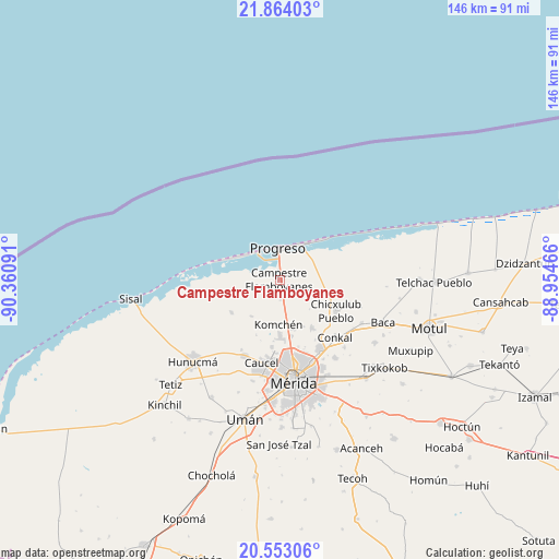
Campestre Flamboyanes GPS coordinates[2]
21° 12' 36" North, 89° 39' 28.008" West
| Map corner | latitude | longitude |
|---|---|---|
| Upper-left | 21.86403°, | -90.36091° |
| Center: | 21.21°, | -89.65778° |
| Lower-right: | 20.55306°, | -88.95466° |
| Map W x H: | 145.8×145.8 km | = 90.6×90.6mi |
| max Lat: | 32.7° ⇑20.8% North |
| Campestre Flamboyanes: | 21.21° |
| min Lat: | ⇓79.2% South 14.53588° |
| min Long | Campestre Flamb | max Long |
| -117.105° | -89.65778° | -86.73105° |
| W 97.9%⇐ | ⇒2.1% E |
Elevation
Elevation of Campestre Flamboyanes is 3 m = 10 ft, and this is 1250.7 m = 4103 ft below average elevation for this country.
| Max E: |
3497 m = 11473 ft | 99.8% |
| Avg. | 1253.7 m = 4113 ft | |
| Campestre Flamboyanes | 3 m = 10 ft | |
Min E: |
-1 m = -3 ft | 0.2% |
See also: Mexico elevation on elevation.city.
Geographical zone
Campestre Flamboyanes is located in North Torrid zone (between Equator and Tropic of Cancer). Distance of this Northern Tropic circle is 247.6 km =153.9 mi to North.| Distance of | km | miles | from Campestre Flamboyanes |
|---|---|---|---|
| North Pole | 7648.7 | 4752.7 | to North |
| Arctic Circle | 5042.8 | 3133.4 | to North |
| Tropic Cancer | 247.6 | 153.9 | to North |
| Equator | 2358.3 | 1465.4 | to South |


Nearby cities:
15 places around Campestre Flamboyanes: (largest is in red/bold)
• Chablekal
15.1 km =9.4 mi,  146°
146°
• Chelem
10.8 km =6.7 mi,  307°
307°
• Chicxulub Pueblo
16.8 km =10.4 mi,  119°
119°
• Chicxulub Puerto
11.4 km =7.1 mi,  32°
32°
• Chuburná
15.5 km =9.6 mi,  290°
290°
• Cosgaya
13.4 km =8.3 mi,  202°
202°
• Dzityá
17.7 km =11 mi,  186°
186°
• Komchén
11.9 km =7.4 mi,  182°
182°
• La Ceiba
13.5 km =8.4 mi,  167°
167°
• Progreso
8.1 km =5 mi,  357°
357°
• San Ignacio
5.6 km =3.5 mi, 177°
• Sierra Papacal
12.1 km =7.5 mi,  218°
218°
• Tamanché
8.1 km =5 mi, 167°
• Xcanatún
15.1 km =9.4 mi, 169°
• Xcunyá
9.8 km =6.1 mi, 151°
Sources, notices
• [Note1] Compared only with cities in Mexico existing in our database
• [Src1] Map data: © OpenStreetMap contributors (CC-BY-SA)
• [Src2] Other city data from geonames.org with taken over terms of usage.
• [Src3] Geographical zone / Annual Mean Temperature by Robert A. Rohde @ Wikipedia
