San Esteban (San Miguel Tateposco) geodata
San Esteban (San Miguel Tateposco) (Jalisco) is a populated place; located in Mexico in America/Mexico_City (GMT-6) time zone. With population of 3,726 people, there are 2466 cities with bigger population in this country. Compared to other cities in Mexico, 73.3% of cities are located further ↓South; 87.6% of cities are located further →East and 50.3% of cities have higher elevation than San Esteban (San Miguel Tateposco). Note1
Current local time in San Esteban (San Miguel Tateposco):
01:40 PM, MondayDifference from your time zone: hours


San Esteban (San Miguel Tateposco) GPS coordinates[2]
20° 47' 56.004" North, 103° 22' 27.984" West
| Map corner | latitude | longitude |
|---|---|---|
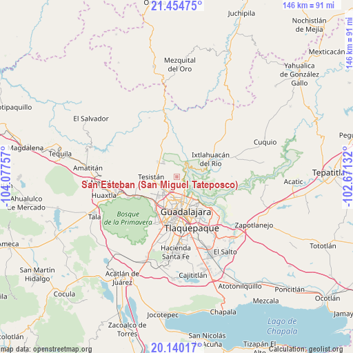
| Upper-left | 21.45475°, | -104.07757° |
| Center: | 20.79889°, | -103.37444° |
| Lower-right: | 20.14017°, | -102.67132° |
| Map W x H: | 146.2×146.2 km | = 90.8×90.8mi |
| max Lat: | 32.7° ⇑26.7% North |
| San Esteban (San Miguel Tateposco): | 20.79889° |
| min Lat: | ⇓73.3% South 14.53588° |
| min Long | San Esteban (Sa | max Long |
| -117.105° | -103.37444° | -86.73105° |
| W 12.4%⇐ | ⇒87.6% E |
Elevation
Elevation of San Esteban (San Miguel Tateposco) is 1418 m = 4652 ft, and this is 164.3 m = 539 ft above average elevation for this country.
| Max E: |
3497 m = 11473 ft | 50.3% |
| San Esteban (San Miguel Tateposco) | 1418 m 4652 ft | |
| Avg. | 1253.7 m = 4113 ft | |
Min E: |
-1 m = -3 ft | 49.7% |
See also: Mexico elevation on elevation.city.
Geographical zone
San Esteban (San Miguel Tateposco) is located in North Torrid zone (between Equator and Tropic of Cancer). Distance of this Northern Tropic circle is 293.3 km =182.2 mi to North.| Distance of | km | miles | from San Esteban (San Miguel Tateposco) |
|---|---|---|---|
| North Pole | 7694.4 | 4781.1 | to North |
| Arctic Circle | 5088.6 | 3161.9 | to North |
| Tropic Cancer | 293.3 | 182.2 | to North |
| Equator | 2312.6 | 1437 | to South |


Nearby cities:
15 places around San Esteban (San Miguel Tateposco): (largest is in red/bold)
• Campestre las Palomas [Fraccionamiento]
8.3 km =5.2 mi,  284°
284°
• Campo Real
7.2 km =4.5 mi,  259°
259°
• Guadalajara
14.8 km =9.2 mi,  187°
187°
• Ixtlahuacán del Río
15.7 km =9.8 mi,  62°
62°
• La Cuchilla (Extramuros de Tesistán)
9.4 km =5.8 mi, 257°
• Mascuala
10.5 km =6.5 mi,  108°
108°
• Nextipac
15.9 km =9.9 mi, 257°
• Nuevo Israel
15.8 km =9.8 mi,  134°
134°
• Nuevo México
8.5 km =5.3 mi,  236°
236°
• Puerta del Llano
9.2 km =5.7 mi, 260°
• Rancho Contento
14.4 km =8.9 mi,  228°
228°
• San Isidro
2.6 km =1.6 mi, 109°
• Tesistán
9.9 km =6.2 mi,  271°
271°
• Zapopan
8.4 km =5.2 mi, 187°
• Zapopan2
9.5 km =5.9 mi,  196°
196°
Sources, notices
• [Note1] Compared only with cities in Mexico existing in our database
• [Src1] Map data: © OpenStreetMap contributors (CC-BY-SA)
• [Src2] Other city data from geonames.org with taken over terms of usage.
• [Src3] Geographical zone / Annual Mean Temperature by Robert A. Rohde @ Wikipedia
