Necoxtla geodata
Necoxtla (Veracruz) is a populated place; located in Mexico in America/Mexico_City (GMT-6) time zone. With population of 2,890 people, there are 3077 cities with bigger population in this country. Compared to other cities in Mexico, 69% of cities are located further ↑North; 72.9% of cities are located further ←West and 75.9% of cities have lower elevation than Necoxtla. Note1


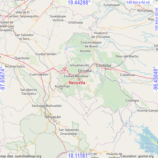
Necoxtla GPS coordinates[2]
18° 46' 42.996" North, 97° 9' 12.996" West
| Map corner | latitude | longitude |
|---|---|---|
| Upper-left | 19.44298°, | -97.85674° |
| Center: | 18.77861°, | -97.15361° |
| Lower-right: | 18.11161°, | -96.45049° |
| Map W x H: | 148×148 km | = 92×92mi |
| max Lat: | 32.7° ⇑69% North |
| Necoxtla: | 18.77861° |
| min Lat: | ⇓31% South 14.53588° |
| min Long | Necoxtla | max Long |
| -117.105° | -97.15361° | -86.73105° |
| W 72.9%⇐ | ⇒27.1% E |
Elevation
Elevation of Necoxtla is 2047 m = 6716 ft, and this is 793.3 m = 2603 ft above average elevation for this country.
| Max E: |
3497 m = 11473 ft | 24.1% |
| Necoxtla | 2047 m 6716 ft | |
| Avg. | 1253.7 m = 4113 ft | |
Min E: |
-1 m = -3 ft | 75.9% |
See also: Mexico elevation on elevation.city.
Geographical zone
Necoxtla is located in North Torrid zone (between Equator and Tropic of Cancer). Distance of this Northern Tropic circle is 517.9 km =321.8 mi to North.| Distance of | km | miles | from Necoxtla |
|---|---|---|---|
| North Pole | 7919.1 | 4920.7 | to North |
| Arctic Circle | 5313.2 | 3301.5 | to North |
| Tropic Cancer | 517.9 | 321.8 | to North |
| Equator | 2088 | 1297.4 | to South |


Nearby cities:
15 places around Necoxtla: (largest is in red/bold)
• Barrio de Tetzmola
1 km =0.6 mi,  174°
174°
• Ciudad Mendoza
4.1 km =2.5 mi,  319°
319°
• El Campanario
4.3 km =2.7 mi,  259°
259°
• Huiloapan de Cuauhtémoc
4.3 km =2.7 mi,  358°
358°
• Huixtitla
5.2 km =3.2 mi,  234°
234°
• La Cuesta
2 km =1.2 mi,  310°
310°
• Monterrey
4.3 km =2.7 mi, 169°
• Nogales
5.6 km =3.5 mi,  349°
349°
• Paseo Nuevo
5.1 km =3.2 mi,  288°
288°
• Soledad Atzompa
2.6 km =1.6 mi, 172°
• Taza de Agua Ojo Zarco
5.1 km =3.2 mi,  275°
275°
• Tlalpan
4 km =2.5 mi,  190°
190°
• Tlatilpa
5.1 km =3.2 mi, 168°
• Tzoncolco
2.9 km =1.8 mi,  99°
99°
• Xonotla
3.9 km =2.4 mi,  176°
176°
Sources, notices
• [Note1] Compared only with cities in Mexico existing in our database
• [Src1] Map data: © OpenStreetMap contributors (CC-BY-SA)
• [Src2] Other city data from geonames.org with taken over terms of usage.
• [Src3] Geographical zone / Annual Mean Temperature by Robert A. Rohde @ Wikipedia
