Santa María Chimalapa geodata
Santa María Chimalapa (Oaxaca) is a populated place; located in Mexico in America/Mexico_City (GMT-6) time zone. With population of 2,540 people, there are 3488 cities with bigger population in this country. Compared to other cities in Mexico, 90.2% of cities are located further ↑North; 85.2% of cities are located further ←West and 72.5% of cities have higher elevation than Santa María Chimalapa. Note1
Current local time in Santa María Chimalapa:
06:48 AM, WednesdayDifference from your time zone: hours


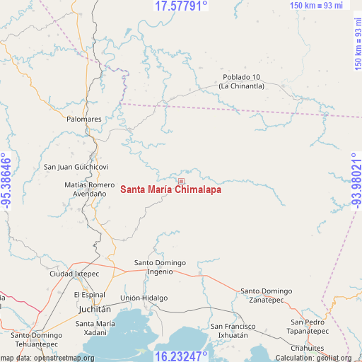
Santa María Chimalapa GPS coordinates[2]
16° 54' 23.004" North, 94° 40' 59.988" West
| Map corner | latitude | longitude |
|---|---|---|
| Upper-left | 17.57791°, | -95.38646° |
| Center: | 16.90639°, | -94.68333° |
| Lower-right: | 16.23247°, | -93.98021° |
| Map W x H: | 149.6×149.6 km | = 93×93mi |
| max Lat: | 32.7° ⇑90.2% North |
| Santa María Chimalapa: | 16.90639° |
| min Lat: | ⇓9.8% South 14.53588° |
| min Long | Santa María Ch | max Long |
| -117.105° | -94.68333° | -86.73105° |
| W 85.2%⇐ | ⇒14.8% E |
Elevation
Elevation of Santa María Chimalapa is 313 m = 1027 ft, and this is 940.7 m = 3086 ft below average elevation for this country.
| Max E: |
3497 m = 11473 ft | 72.5% |
| Avg. | 1253.7 m = 4113 ft | |
| Santa María Chimalapa | 313 m = 1027 ft | |
Min E: |
-1 m = -3 ft | 27.5% |
See also: Mexico elevation on elevation.city.
Geographical zone
Santa María Chimalapa is located in North Torrid zone (between Equator and Tropic of Cancer). Distance of this Northern Tropic circle is 726.1 km =451.2 mi to North.| Distance of | km | miles | from Santa María Chimalapa |
|---|---|---|---|
| North Pole | 8127.2 | 5050 | to North |
| Arctic Circle | 5521.4 | 3430.8 | to North |
| Tropic Cancer | 726.1 | 451.2 | to North |
| Equator | 1879.8 | 1168.1 | to South |


Nearby cities:
15 places around Santa María Chimalapa: (largest is in red/bold)
• Barreña
29.9 km =18.6 mi,  276°
276°
• Chivixhuyo
31.7 km =19.7 mi,  250°
250°
• Cuauhtémoc
30.5 km =19 mi,  315°
315°
• El Bajío
37.5 km =23.3 mi,  267°
267°
• El Porvenir
30.5 km =19 mi,  200°
200°
• Jorge L. Tamayo (Poblado Dos)
37.9 km =23.5 mi,  5°
5°
• La Blanca
34.7 km =21.6 mi,  181°
181°
• La Esmeralda
30.9 km =19.2 mi,  338°
338°
• Las Conchas
27.3 km =17 mi,  187°
187°
• Lázaro Cárdenas
27.3 km =17 mi,  223°
223°
• Matías Romero
38 km =23.6 mi, 265°
• Paso del Moral
37.7 km =23.4 mi, 13°
• Piedra Blanca
36.2 km =22.5 mi, 284°
• San Miguel Chimalapa
22.5 km =14 mi, 197°
• Santiago Ixtaltepec
33.9 km =21.1 mi, 224°
Sources, notices
• [Note1] Compared only with cities in Mexico existing in our database
• [Src1] Map data: © OpenStreetMap contributors (CC-BY-SA)
• [Src2] Other city data from geonames.org with taken over terms of usage.
• [Src3] Geographical zone / Annual Mean Temperature by Robert A. Rohde @ Wikipedia
