Buenavista de Juárez geodata
Buenavista de Juárez (Puebla) is a populated place; located in Mexico in America/Mexico_City (GMT-6) time zone. With population of 1,892 people, there are 4600 cities with bigger population in this country. Compared to other cities in Mexico, 66% of cities are located further ↑North; 65.7% of cities are located further ←West and 79.9% of cities have lower elevation than Buenavista de Juárez. Note1
Current local time in Buenavista de Juárez:
08:33 AM, WednesdayDifference from your time zone: hours


Buenavista de Juárez GPS coordinates[2]
18° 56' 42" North, 97° 49' 40.008" West
| Map corner | latitude | longitude |
|---|---|---|
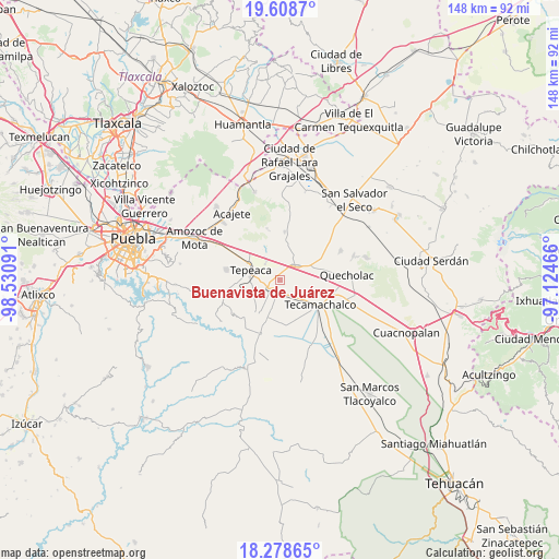
| Upper-left | 19.6087°, | -98.53091° |
| Center: | 18.945°, | -97.82778° |
| Lower-right: | 18.27865°, | -97.12466° |
| Map W x H: | 147.9×147.9 km | = 91.9×91.9mi |
| max Lat: | 32.7° ⇑66% North |
| Buenavista de Juárez: | 18.945° |
| min Lat: | ⇓34% South 14.53588° |
| min Long | Buenavista de J | max Long |
| -117.105° | -97.82778° | -86.73105° |
| W 65.7%⇐ | ⇒34.3% E |
Elevation
Elevation of Buenavista de Juárez is 2137 m = 7011 ft, and this is 883.3 m = 2898 ft above average elevation for this country.
| Max E: |
3497 m = 11473 ft | 20.1% |
| Buenavista de Juárez | 2137 m 7011 ft | |
| Avg. | 1253.7 m = 4113 ft | |
Min E: |
-1 m = -3 ft | 79.9% |
See also: Mexico elevation on elevation.city.
Geographical zone
Buenavista de Juárez is located in North Torrid zone (between Equator and Tropic of Cancer). Distance of this Northern Tropic circle is 499.4 km =310.3 mi to North.| Distance of | km | miles | from Buenavista de Juárez |
|---|---|---|---|
| North Pole | 7900.6 | 4909.2 | to North |
| Arctic Circle | 5294.7 | 3290 | to North |
| Tropic Cancer | 499.4 | 310.3 | to North |
| Equator | 2106.5 | 1308.9 | to South |


Nearby cities:
15 places around Buenavista de Juárez: (largest is in red/bold)
• Acatzingo
6.2 km =3.9 mi,  48°
48°
• Actipan de Morelos
3.5 km =2.2 mi,  61°
61°
• Chipiltepec
6.7 km =4.2 mi,  191°
191°
• Cuapiaxtla de Madero
3.3 km =2.1 mi,  172°
172°
• Guadalupe Calderón
4 km =2.5 mi,  306°
306°
• Huixcolotla
6.5 km =4 mi,  114°
114°
• Los Reyes de Juárez
2.6 km =1.6 mi,  79°
79°
• Miguel Negrete
0.8 km =0.5 mi,  349°
349°
• San Cristóbal los Nava
5.6 km =3.5 mi,  355°
355°
• San Hipólito
4.8 km =3 mi,  264°
264°
• San Martín Caltenco
6.8 km =4.2 mi, 172°
• San Mateo Parra
6.3 km =3.9 mi,  325°
325°
• San Nicolás Zoyapetlayoca
4.6 km =2.9 mi,  239°
239°
• Santiago Acozac
2.2 km =1.4 mi, 51°
• Zahuatlán de Morelos (San José)
6 km =3.7 mi,  315°
315°
Sources, notices
• [Note1] Compared only with cities in Mexico existing in our database
• [Src1] Map data: © OpenStreetMap contributors (CC-BY-SA)
• [Src2] Other city data from geonames.org with taken over terms of usage.
• [Src3] Geographical zone / Annual Mean Temperature by Robert A. Rohde @ Wikipedia
