San Nicolás Zoyapetlayoca geodata
San Nicolás Zoyapetlayoca (Puebla) is a populated place; located in Mexico in America/Mexico_City (GMT-6) time zone. With population of 3,579 people, there are 2555 cities with bigger population in this country. Compared to other cities in Mexico, 66.4% of cities are located further ↑North; 65.3% of cities are located further ←West and 78.1% of cities have lower elevation than San Nicolás Zoyapetlayoca. Note1
Current local time in San Nicolás Zoyapetlayoca:
09:05 AM, MondayDifference from your time zone: hours


San Nicolás Zoyapetlayoca GPS coordinates[2]
18° 55' 27.012" North, 97° 51' 55.008" West
| Map corner | latitude | longitude |
|---|---|---|
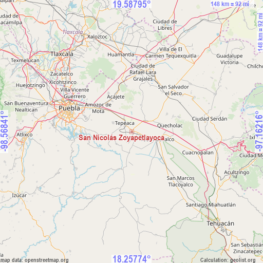
| Upper-left | 19.58795°, | -98.56841° |
| Center: | 18.92417°, | -97.86528° |
| Lower-right: | 18.25774°, | -97.16216° |
| Map W x H: | 147.9×147.9 km | = 91.9×91.9mi |
| max Lat: | 32.7° ⇑66.4% North |
| San Nicolás Zoyapetlayoca: | 18.92417° |
| min Lat: | ⇓33.6% South 14.53588° |
| min Long | San Nicolás Zo | max Long |
| -117.105° | -97.86528° | -86.73105° |
| W 65.3%⇐ | ⇒34.7% E |
Elevation
Elevation of San Nicolás Zoyapetlayoca is 2091 m = 6860 ft, and this is 837.3 m = 2747 ft above average elevation for this country.
| Max E: |
3497 m = 11473 ft | 21.9% |
| San Nicolás Zoyapetlayoca | 2091 m 6860 ft | |
| Avg. | 1253.7 m = 4113 ft | |
Min E: |
-1 m = -3 ft | 78.1% |
See also: Mexico elevation on elevation.city.
Geographical zone
San Nicolás Zoyapetlayoca is located in North Torrid zone (between Equator and Tropic of Cancer). Distance of this Northern Tropic circle is 501.7 km =311.7 mi to North.| Distance of | km | miles | from San Nicolás Zoyapetlayoca |
|---|---|---|---|
| North Pole | 7902.9 | 4910.6 | to North |
| Arctic Circle | 5297 | 3291.4 | to North |
| Tropic Cancer | 501.7 | 311.7 | to North |
| Equator | 2104.2 | 1307.5 | to South |


Nearby cities:
15 places around San Nicolás Zoyapetlayoca: (largest is in red/bold)
• Actipan
4.2 km =2.6 mi,  289°
289°
• Buenavista de Juárez
4.6 km =2.9 mi,  59°
59°
• Chipiltepec
5 km =3.1 mi,  148°
148°
• Cuapiaxtla de Madero
4.5 km =2.8 mi,  102°
102°
• Guadalupe Calderón
4.7 km =2.9 mi,  8°
8°
• Hueyotlipan
3.6 km =2.2 mi,  180°
180°
• Miguel Negrete
4.9 km =3 mi,  50°
50°
• Mixtla
3.8 km =2.4 mi,  236°
236°
• San Hipólito
2 km =1.2 mi,  335°
335°
• San Martín Caltenco
6.6 km =4.1 mi,  131°
131°
• San Simón Coatepec
2.7 km =1.7 mi,  248°
248°
• Santiago Acozac
6.7 km =4.2 mi, 57°
• Tepeaca
6 km =3.7 mi,  322°
322°
• Zacaola
5.1 km =3.2 mi,  158°
158°
• Zahuatlán de Morelos (San José)
6.6 km =4.1 mi,  357°
357°
Sources, notices
• [Note1] Compared only with cities in Mexico existing in our database
• [Src1] Map data: © OpenStreetMap contributors (CC-BY-SA)
• [Src2] Other city data from geonames.org with taken over terms of usage.
• [Src3] Geographical zone / Annual Mean Temperature by Robert A. Rohde @ Wikipedia
