Guadalupe Calderón geodata
Guadalupe Calderón (Puebla) is a populated place; located in Mexico in America/Mexico_City (GMT-6) time zone. With population of 1,100 people, there are 7910 cities with bigger population in this country. Compared to other cities in Mexico, 65.4% of cities are located further ↑North; 65.3% of cities are located further ←West and 83.5% of cities have lower elevation than Guadalupe Calderón. Note1


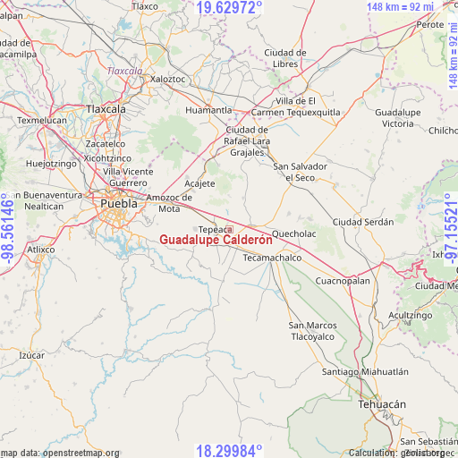
Guadalupe Calderón GPS coordinates[2]
18° 57' 57.996" North, 97° 51' 29.988" West
| Map corner | latitude | longitude |
|---|---|---|
| Upper-left | 19.62972°, | -98.56146° |
| Center: | 18.96611°, | -97.85833° |
| Lower-right: | 18.29984°, | -97.15521° |
| Map W x H: | 147.9×147.9 km | = 91.9×91.9mi |
| max Lat: | 32.7° ⇑65.4% North |
| Guadalupe Calderón: | 18.96611° |
| min Lat: | ⇓34.6% South 14.53588° |
| min Long | Guadalupe Calde | max Long |
| -117.105° | -97.85833° | -86.73105° |
| W 65.3%⇐ | ⇒34.7% E |
Elevation
Elevation of Guadalupe Calderón is 2232 m = 7323 ft, and this is 978.3 m = 3210 ft above average elevation for this country.
| Max E: |
3497 m = 11473 ft | 16.5% |
| Guadalupe Calderón | 2232 m 7323 ft | |
| Avg. | 1253.7 m = 4113 ft | |
Min E: |
-1 m = -3 ft | 83.5% |
See also: Mexico elevation on elevation.city.
Geographical zone
Guadalupe Calderón is located in North Torrid zone (between Equator and Tropic of Cancer). Distance of this Northern Tropic circle is 497.1 km =308.9 mi to North.| Distance of | km | miles | from Guadalupe Calderón |
|---|---|---|---|
| North Pole | 7898.2 | 4907.7 | to North |
| Arctic Circle | 5292.3 | 3288.5 | to North |
| Tropic Cancer | 497.1 | 308.9 | to North |
| Equator | 2108.8 | 1310.3 | to South |


Nearby cities:
15 places around Guadalupe Calderón: (largest is in red/bold)
• Actipan
5.7 km =3.5 mi,  235°
235°
• Actipan de Morelos
6.3 km =3.9 mi,  96°
96°
• Benito Juárez
4.8 km =3 mi,  1°
1°
• Buenavista de Juárez
4 km =2.5 mi,  126°
126°
• Los Reyes de Juárez
6 km =3.7 mi,  108°
108°
• Miguel Negrete
3.4 km =2.1 mi,  116°
116°
• San Cristóbal los Nava
4.3 km =2.7 mi,  40°
40°
• San Hipólito
3.2 km =2 mi,  208°
208°
• San José Carpinteros
6.4 km =4 mi,  299°
299°
• San Mateo Parra
2.8 km =1.7 mi,  352°
352°
• San Nicolás Zoyapetlayoca
4.7 km =2.9 mi,  188°
188°
• San Simón Coatepec
6.5 km =4 mi, 209°
• Santiago Acozac
5 km =3.1 mi, 101°
• Tepeaca
4.4 km =2.7 mi,  271°
271°
• Zahuatlán de Morelos (San José)
2.1 km =1.3 mi,  333°
333°
Sources, notices
• [Note1] Compared only with cities in Mexico existing in our database
• [Src1] Map data: © OpenStreetMap contributors (CC-BY-SA)
• [Src2] Other city data from geonames.org with taken over terms of usage.
• [Src3] Geographical zone / Annual Mean Temperature by Robert A. Rohde @ Wikipedia
