San Hipólito geodata
San Hipólito (Puebla) is a populated place; located in Mexico in America/Mexico_City (GMT-6) time zone. With population of 8,999 people, there are 1052 cities with bigger population in this country. Compared to other cities in Mexico, 66% of cities are located further ↑North; 65.2% of cities are located further ←West and 80.7% of cities have lower elevation than San Hipólito. Note1


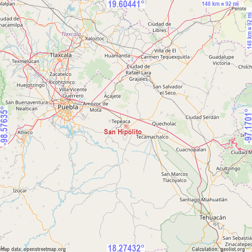
San Hipólito GPS coordinates[2]
18° 56' 26.484" North, 97° 52' 23.592" West
| Map corner | latitude | longitude |
|---|---|---|
| Upper-left | 19.60441°, | -98.57635° |
| Center: | 18.94069°, | -97.87322° |
| Lower-right: | 18.27432°, | -97.1701° |
| Map W x H: | 147.9×147.9 km | = 91.9×91.9mi |
| max Lat: | 32.7° ⇑66% North |
| San Hipólito: | 18.94069° |
| min Lat: | ⇓34% South 14.53588° |
| min Long | San Hipólito | max Long |
| -117.105° | -97.87322° | -86.73105° |
| W 65.2%⇐ | ⇒34.8% E |
Elevation
Elevation of San Hipólito is 2157 m = 7077 ft, and this is 903.3 m = 2964 ft above average elevation for this country.
| Max E: |
3497 m = 11473 ft | 19.3% |
| San Hipólito | 2157 m 7077 ft | |
| Avg. | 1253.7 m = 4113 ft | |
Min E: |
-1 m = -3 ft | 80.7% |
See also: Mexico elevation on elevation.city.
Geographical zone
San Hipólito is located in North Torrid zone (between Equator and Tropic of Cancer). Distance of this Northern Tropic circle is 499.9 km =310.6 mi to North.| Distance of | km | miles | from San Hipólito |
|---|---|---|---|
| North Pole | 7901.1 | 4909.5 | to North |
| Arctic Circle | 5295.2 | 3290.3 | to North |
| Tropic Cancer | 499.9 | 310.6 | to North |
| Equator | 2106 | 1308.6 | to South |


Nearby cities:
15 places around San Hipólito: (largest is in red/bold)
• Actipan
3.1 km =1.9 mi,  262°
262°
• Buenavista de Juárez
4.8 km =3 mi,  84°
84°
• Chipiltepec
7 km =4.3 mi,  150°
150°
• Cuapiaxtla de Madero
5.9 km =3.7 mi,  118°
118°
• Guadalupe Calderón
3.2 km =2 mi,  28°
28°
• Hueyotlipan
5.5 km =3.4 mi,  171°
171°
• Miguel Negrete
4.8 km =3 mi,  74°
74°
• Mixtla
4.6 km =2.9 mi,  210°
210°
• San Luis Ajajalpan
6.4 km =4 mi,  265°
265°
• San Mateo Parra
5.8 km =3.6 mi,  12°
12°
• San Nicolás Zoyapetlayoca
2 km =1.2 mi,  155°
155°
• San Simón Coatepec
3.3 km =2.1 mi, 210°
• Santiago Acozac
6.7 km =4.2 mi, 74°
• Tepeaca
4 km =2.5 mi,  316°
316°
• Zahuatlán de Morelos (San José)
4.8 km =3 mi, 7°
Sources, notices
• [Note1] Compared only with cities in Mexico existing in our database
• [Src1] Map data: © OpenStreetMap contributors (CC-BY-SA)
• [Src2] Other city data from geonames.org with taken over terms of usage.
• [Src3] Geographical zone / Annual Mean Temperature by Robert A. Rohde @ Wikipedia
