Lázaro Cárdenas (El Empalme) geodata
Lázaro Cárdenas (El Empalme) (Morelos) is a populated place; located in Mexico in America/Mexico_City (GMT-6) time zone. With population of 1,507 people, there are 5723 cities with bigger population in this country. Compared to other cities in Mexico, 66.2% of cities are located further ↑North; 50.2% of cities are located further →East and 53.1% of cities have higher elevation than Lázaro Cárdenas (El Empalme). Note1
Current local time in Lázaro Cárdenas (El Empalme):
08:30 AM, WednesdayDifference from your time zone: hours


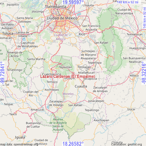
Lázaro Cárdenas (El Empalme) GPS coordinates[2]
18° 55' 55.992" North, 99° 1' 31.008" West
| Map corner | latitude | longitude |
|---|---|---|
| Upper-left | 19.59597°, | -99.72841° |
| Center: | 18.93222°, | -99.02528° |
| Lower-right: | 18.26582°, | -98.32216° |
| Map W x H: | 147.9×147.9 km | = 91.9×91.9mi |
| max Lat: | 32.7° ⇑66.2% North |
| Lázaro Cárdenas (El Empalme): | 18.93222° |
| min Lat: | ⇓33.8% South 14.53588° |
| min Long | Lázaro Cárden | max Long |
| -117.105° | -99.02528° | -86.73105° |
| W 49.8%⇐ | ⇒50.2% E |
Elevation
Elevation of Lázaro Cárdenas (El Empalme) is 1285 m = 4216 ft, and this is 31.3 m = 103 ft above average elevation for this country.
| Max E: |
3497 m = 11473 ft | 53.1% |
| Lázaro Cárdenas (El Empalme) | 1285 m 4216 ft | |
| Avg. | 1253.7 m = 4113 ft | |
Min E: |
-1 m = -3 ft | 46.9% |
See also: Mexico elevation on elevation.city.
Geographical zone
Lázaro Cárdenas (El Empalme) is located in North Torrid zone (between Equator and Tropic of Cancer). Distance of this Northern Tropic circle is 500.9 km =311.2 mi to North.| Distance of | km | miles | from Lázaro Cárdenas (El Empalme) |
|---|---|---|---|
| North Pole | 7902 | 4910.1 | to North |
| Arctic Circle | 5296.1 | 3290.8 | to North |
| Tropic Cancer | 500.9 | 311.2 | to North |
| Equator | 2105.1 | 1308 | to South |


Nearby cities:
15 places around Lázaro Cárdenas (El Empalme): (largest is in red/bold)
• Amatlán de Quetzalcoatl
5 km =3.1 mi,  345°
345°
• Colonia Huilotepec
6.3 km =3.9 mi,  310°
310°
• Colonia Obrera
1.4 km =0.9 mi,  267°
267°
• Colonia Puente Pantitlán
3.9 km =2.4 mi,  107°
107°
• Colonia Ángel Bocanegra (Adolfo López Mateos)
0.8 km =0.5 mi,  215°
215°
• Corral Grande
5.8 km =3.6 mi,  93°
93°
• El Golán
2 km =1.2 mi,  61°
61°
• El Zarco
4.5 km =2.8 mi,  250°
250°
• Ignacio Bastida (Santa Catarina Tlayca)
1.5 km =0.9 mi,  51°
51°
• Itzamatitlán
2.6 km =1.6 mi,  173°
173°
• Las Vivianas
0.3 km =0.2 mi,  242°
242°
• Los Arcos
5 km =3.1 mi,  178°
178°
• Nacatongo
5 km =3.1 mi,  73°
73°
• Oacalco
1.1 km =0.7 mi,  203°
203°
• Tlayacapan
5.3 km =3.3 mi, 60°
Sources, notices
• [Note1] Compared only with cities in Mexico existing in our database
• [Src1] Map data: © OpenStreetMap contributors (CC-BY-SA)
• [Src2] Other city data from geonames.org with taken over terms of usage.
• [Src3] Geographical zone / Annual Mean Temperature by Robert A. Rohde @ Wikipedia
