Muquén geodata
Muquén (Chiapas) is a populated place; located in Mexico in America/Mexico_City (GMT-6) time zone. With population of 1,480 people, there are 5826 cities with bigger population in this country. Compared to other cities in Mexico, 91.6% of cities are located further ↑North; 91.1% of cities are located further ←West and 87% of cities have lower elevation than Muquén. Note1


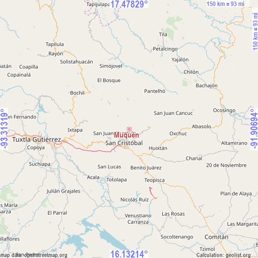
Muquén GPS coordinates[2]
16° 48' 23.076" North, 92° 36' 36.216" West
| Map corner | latitude | longitude |
|---|---|---|
| Upper-left | 17.47829°, | -93.31319° |
| Center: | 16.80641°, | -92.61006° |
| Lower-right: | 16.13214°, | -91.90694° |
| Map W x H: | 149.7×149.7 km | = 93×93mi |
| max Lat: | 32.7° ⇑91.6% North |
| Muquén: | 16.80641° |
| min Lat: | ⇓8.4% South 14.53588° |
| min Long | Muquén | max Long |
| -117.105° | -92.61006° | -86.73105° |
| W 91.1%⇐ | ⇒8.9% E |
Elevation
Elevation of Muquén is 2310 m = 7579 ft, and this is 1056.3 m = 3466 ft above average elevation for this country.
| Max E: |
3497 m = 11473 ft | 13% |
| Muquén | 2310 m 7579 ft | |
| Avg. | 1253.7 m = 4113 ft | |
Min E: |
-1 m = -3 ft | 87% |
See also: Mexico elevation on elevation.city.
Geographical zone
Muquén is located in North Torrid zone (between Equator and Tropic of Cancer). Distance of this Northern Tropic circle is 737.2 km =458.1 mi to North.| Distance of | km | miles | from Muquén |
|---|---|---|---|
| North Pole | 8138.4 | 5057 | to North |
| Arctic Circle | 5532.5 | 3437.7 | to North |
| Tropic Cancer | 737.2 | 458.1 | to North |
| Equator | 1868.7 | 1161.2 | to South |


Nearby cities:
15 places around Muquén: (largest is in red/bold)
• Chilimjoveltic
3.9 km =2.4 mi,  122°
122°
• Chiotic
4.8 km =3 mi,  341°
341°
• El Crucero
4.7 km =2.9 mi,  98°
98°
• El Pinar
5.4 km =3.4 mi,  174°
174°
• Joltzemén
1.2 km =0.7 mi,  272°
272°
• Kotolte
6 km =3.7 mi,  78°
78°
• Pajaltón Alto
4.8 km =3 mi,  57°
57°
• Saclamantón
3.3 km =2.1 mi,  232°
232°
• Sactzu
1.2 km =0.7 mi, 172°
• Shucutón
5 km =3.1 mi,  301°
301°
• Tzajalchén
5.1 km =3.2 mi,  311°
311°
• Tzontehuitz
4.4 km =2.7 mi,  47°
47°
• Yitic
5.9 km =3.7 mi, 342°
• Yolonan
2.7 km =1.7 mi, 344°
• Yutniotic
4.2 km =2.6 mi,  294°
294°
Sources, notices
• [Note1] Compared only with cities in Mexico existing in our database
• [Src1] Map data: © OpenStreetMap contributors (CC-BY-SA)
• [Src2] Other city data from geonames.org with taken over terms of usage.
• [Src3] Geographical zone / Annual Mean Temperature by Robert A. Rohde @ Wikipedia
