Las Trojas geodata
Las Trojas (Guanajuato) is a populated place; located in Mexico in America/Mexico_City (GMT-6) time zone. With population of 1,442 people, there are 5987 cities with bigger population in this country. Compared to other cities in Mexico, 71.9% of cities are located further ↓South; 71.7% of cities are located further →East and 64.1% of cities have lower elevation than Las Trojas. Note1


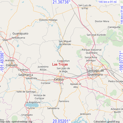
Las Trojas GPS coordinates[2]
20° 42' 39.996" North, 100° 46' 50.988" West
| Map corner | latitude | longitude |
|---|---|---|
| Upper-left | 21.36736°, | -101.48396° |
| Center: | 20.71111°, | -100.78083° |
| Lower-right: | 20.05201°, | -100.07771° |
| Map W x H: | 146.3×146.3 km | = 90.9×90.9mi |
| max Lat: | 32.7° ⇑28.1% North |
| Las Trojas: | 20.71111° |
| min Lat: | ⇓71.9% South 14.53588° |
| min Long | Las Trojas | max Long |
| -117.105° | -100.78083° | -86.73105° |
| W 28.3%⇐ | ⇒71.7% E |
Elevation
Elevation of Las Trojas is 1804 m = 5919 ft, and this is 550.3 m = 1805 ft above average elevation for this country.
| Max E: |
3497 m = 11473 ft | 35.9% |
| Las Trojas | 1804 m 5919 ft | |
| Avg. | 1253.7 m = 4113 ft | |
Min E: |
-1 m = -3 ft | 64.1% |
See also: Mexico elevation on elevation.city.
Geographical zone
Las Trojas is located in North Torrid zone (between Equator and Tropic of Cancer). Distance of this Northern Tropic circle is 303.1 km =188.3 mi to North.| Distance of | km | miles | from Las Trojas |
|---|---|---|---|
| North Pole | 7704.2 | 4787.2 | to North |
| Arctic Circle | 5098.3 | 3167.9 | to North |
| Tropic Cancer | 303.1 | 188.3 | to North |
| Equator | 2302.9 | 1431 | to South |


Nearby cities:
15 places around Las Trojas: (largest is in red/bold)
• Comonfort
2.6 km =1.6 mi,  59°
59°
• Empalme Escobedo
5.6 km =3.5 mi,  140°
140°
• Guadalupe
7.2 km =4.5 mi,  151°
151°
• Jalpilla
6.6 km =4.1 mi,  70°
70°
• La Laguna
1.3 km =0.8 mi,  233°
233°
• Las Gallinas
8.6 km =5.3 mi, 59°
• Morales
8 km =5 mi,  338°
338°
• Neutla
6.1 km =3.8 mi,  266°
266°
• Orduña de Abajo
5.2 km =3.2 mi,  357°
357°
• Orduña de Arriba
6.2 km =3.9 mi,  348°
348°
• Presa Blanca
7.8 km =4.8 mi,  188°
188°
• Rinconcillo (Rinconcillo de los Remedios)
9 km =5.6 mi, 344°
• San Antonio Espinoza
6.7 km =4.2 mi, 193°
• San Isidro (La Loma)
1.1 km =0.7 mi, 150°
• San Pablo
9 km =5.6 mi, 338°
Sources, notices
• [Note1] Compared only with cities in Mexico existing in our database
• [Src1] Map data: © OpenStreetMap contributors (CC-BY-SA)
• [Src2] Other city data from geonames.org with taken over terms of usage.
• [Src3] Geographical zone / Annual Mean Temperature by Robert A. Rohde @ Wikipedia
