San Jerónimo Coaltepec geodata
San Jerónimo Coaltepec (Puebla) is a populated place; located in Mexico in America/Mexico_City (GMT-6) time zone. With population of 1,438 people, there are 6005 cities with bigger population in this country. Compared to other cities in Mexico, 57% of cities are located further ↓South; 65.2% of cities are located further ←West and 52.1% of cities have higher elevation than San Jerónimo Coaltepec. Note1
Current local time in San Jerónimo Coaltepec:
08:44 AM, WednesdayDifference from your time zone: hours


San Jerónimo Coaltepec GPS coordinates[2]
20° 0' 14.004" North, 97° 51' 59.004" West
| Map corner | latitude | longitude |
|---|---|---|
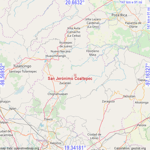
| Upper-left | 20.6632°, | -98.56952° |
| Center: | 20.00389°, | -97.86639° |
| Lower-right: | 19.34181°, | -97.16327° |
| Map W x H: | 146.9×146.9 km | = 91.3×91.3mi |
| max Lat: | 32.7° ⇑43% North |
| San Jerónimo Coaltepec: | 20.00389° |
| min Lat: | ⇓57% South 14.53588° |
| min Long | San Jerónimo C | max Long |
| -117.105° | -97.86639° | -86.73105° |
| W 65.2%⇐ | ⇒34.8% E |
Elevation
Elevation of San Jerónimo Coaltepec is 1333 m = 4373 ft, and this is 79.3 m = 260 ft above average elevation for this country.
| Max E: |
3497 m = 11473 ft | 52.1% |
| San Jerónimo Coaltepec | 1333 m 4373 ft | |
| Avg. | 1253.7 m = 4113 ft | |
Min E: |
-1 m = -3 ft | 47.9% |
See also: Mexico elevation on elevation.city.
Geographical zone
San Jerónimo Coaltepec is located in North Torrid zone (between Equator and Tropic of Cancer). Distance of this Northern Tropic circle is 381.7 km =237.2 mi to North.| Distance of | km | miles | from San Jerónimo Coaltepec |
|---|---|---|---|
| North Pole | 7782.8 | 4836 | to North |
| Arctic Circle | 5177 | 3216.8 | to North |
| Tropic Cancer | 381.7 | 237.2 | to North |
| Equator | 2224.2 | 1382.1 | to South |


Nearby cities:
15 places around San Jerónimo Coaltepec: (largest is in red/bold)
• Ahuacatlán
0.8 km =0.5 mi,  71°
71°
• Chicometepec (San Simón)
6.1 km =3.8 mi,  139°
139°
• Jilotzingo
4.9 km =3 mi,  310°
310°
• Pochálcatl
1.3 km =0.8 mi,  94°
94°
• San Marcos Eloxochitlán
2.4 km =1.5 mi,  346°
346°
• Tepango
7.3 km =4.5 mi, 90°
• Tepetzintla
4.8 km =3 mi,  147°
147°
• Tlacotepec (San Mateo)
6.5 km =4 mi,  16°
16°
• Tlamanca de Hernández
7.6 km =4.7 mi,  134°
134°
• Tlaquimpa
4.8 km =3 mi,  197°
197°
• Tlayehualancingo
5.3 km =3.3 mi,  52°
52°
• Tonalapa (Santa Bárbara)
4.5 km =2.8 mi,  26°
26°
• Tonalixco
3.8 km =2.4 mi, 131°
• Xochicuautla
6 km =3.7 mi,  336°
336°
• Xochitlaxco (San Baltazar)
7 km =4.3 mi,  177°
177°
Sources, notices
• [Note1] Compared only with cities in Mexico existing in our database
• [Src1] Map data: © OpenStreetMap contributors (CC-BY-SA)
• [Src2] Other city data from geonames.org with taken over terms of usage.
• [Src3] Geographical zone / Annual Mean Temperature by Robert A. Rohde @ Wikipedia
