Chicometepec (San Simón) geodata
Chicometepec (San Simón) (Puebla) is a populated place; located in Mexico in America/Mexico_City (GMT-6) time zone. With population of 890 people, there are 9797 cities with bigger population in this country. Compared to other cities in Mexico, 56.2% of cities are located further ↓South; 65.7% of cities are located further ←West and 67.3% of cities have lower elevation than Chicometepec (San Simón). Note1
Current local time in Chicometepec (San Simón):
07:07 AM, WednesdayDifference from your time zone: hours


Chicometepec (San Simón) GPS coordinates[2]
19° 57' 45" North, 97° 49' 41.988" West
| Map corner | latitude | longitude |
|---|---|---|
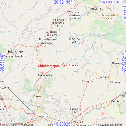
| Upper-left | 20.62198°, | -98.53146° |
| Center: | 19.9625°, | -97.82833° |
| Lower-right: | 19.30025°, | -97.12521° |
| Map W x H: | 147×147 km | = 91.3×91.3mi |
| max Lat: | 32.7° ⇑43.8% North |
| Chicometepec (San Simón): | 19.9625° |
| min Lat: | ⇓56.2% South 14.53588° |
| min Long | Chicometepec (S | max Long |
| -117.105° | -97.82833° | -86.73105° |
| W 65.7%⇐ | ⇒34.3% E |
Elevation
Elevation of Chicometepec (San Simón) is 1875 m = 6152 ft, and this is 621.3 m = 2038 ft above average elevation for this country.
| Max E: |
3497 m = 11473 ft | 32.7% |
| Chicometepec (San Simón) | 1875 m 6152 ft | |
| Avg. | 1253.7 m = 4113 ft | |
Min E: |
-1 m = -3 ft | 67.3% |
See also: Mexico elevation on elevation.city.
Geographical zone
Chicometepec (San Simón) is located in North Torrid zone (between Equator and Tropic of Cancer). Distance of this Northern Tropic circle is 386.3 km =240 mi to North.| Distance of | km | miles | from Chicometepec (San Simón) |
|---|---|---|---|
| North Pole | 7787.4 | 4838.9 | to North |
| Arctic Circle | 5181.6 | 3219.7 | to North |
| Tropic Cancer | 386.3 | 240 | to North |
| Equator | 2219.6 | 1379.2 | to South |


Nearby cities:
15 places around Chicometepec (San Simón): (largest is in red/bold)
• Ahuacatlán
5.8 km =3.6 mi,  326°
326°
• Ahuatlán
5.3 km =3.3 mi,  159°
159°
• Cerro Verde (Ejecatepeco)
5.4 km =3.4 mi,  139°
139°
• Cuautempan
6.4 km =4 mi,  147°
147°
• Pochálcatl
5.2 km =3.2 mi, 329°
• San Jerónimo Coaltepec
6.1 km =3.8 mi,  319°
319°
• Tenepanigia (Santa Elena)
5.9 km =3.7 mi,  86°
86°
• Tepango
5.6 km =3.5 mi,  36°
36°
• Tepetzintla
1.5 km =0.9 mi,  290°
290°
• Tlamanca de Hernández
1.6 km =1 mi,  117°
117°
• Tlapacholoya
4.8 km =3 mi, 118°
• Tlaquimpa
5.5 km =3.4 mi,  270°
270°
• Tonalixco
2.4 km =1.5 mi, 330°
• Totomoxtla
3.6 km =2.2 mi, 147°
• Xochitlaxco (San Baltazar)
4.4 km =2.7 mi,  237°
237°
Sources, notices
• [Note1] Compared only with cities in Mexico existing in our database
• [Src1] Map data: © OpenStreetMap contributors (CC-BY-SA)
• [Src2] Other city data from geonames.org with taken over terms of usage.
• [Src3] Geographical zone / Annual Mean Temperature by Robert A. Rohde @ Wikipedia
