Xochicuautla geodata
Xochicuautla (Puebla) is a populated place; located in Mexico in America/Mexico_City (GMT-6) time zone. With population of 1,464 people, there are 5902 cities with bigger population in this country. Compared to other cities in Mexico, 58.1% of cities are located further ↓South; 65% of cities are located further ←West and 51.9% of cities have lower elevation than Xochicuautla. Note1


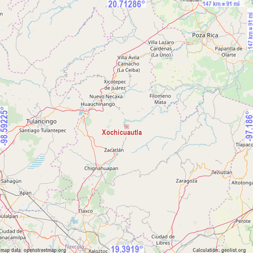
Xochicuautla GPS coordinates[2]
20° 3' 13.572" North, 97° 53' 20.832" West
| Map corner | latitude | longitude |
|---|---|---|
| Upper-left | 20.71286°, | -98.59225° |
| Center: | 20.05377°, | -97.88912° |
| Lower-right: | 19.3919°, | -97.186° |
| Map W x H: | 146.9×146.9 km | = 91.3×91.3mi |
| max Lat: | 32.7° ⇑41.9% North |
| Xochicuautla: | 20.05377° |
| min Lat: | ⇓58.1% South 14.53588° |
| min Long | Xochicuautla | max Long |
| -117.105° | -97.88912° | -86.73105° |
| W 65%⇐ | ⇒35% E |
Elevation
Elevation of Xochicuautla is 1521 m = 4990 ft, and this is 267.3 m = 877 ft above average elevation for this country.
| Max E: |
3497 m = 11473 ft | 48.1% |
| Xochicuautla | 1521 m 4990 ft | |
| Avg. | 1253.7 m = 4113 ft | |
Min E: |
-1 m = -3 ft | 51.9% |
See also: Mexico elevation on elevation.city.
Geographical zone
Xochicuautla is located in North Torrid zone (between Equator and Tropic of Cancer). Distance of this Northern Tropic circle is 376.1 km =233.7 mi to North.| Distance of | km | miles | from Xochicuautla |
|---|---|---|---|
| North Pole | 7777.3 | 4832.6 | to North |
| Arctic Circle | 5171.4 | 3213.4 | to North |
| Tropic Cancer | 376.1 | 233.7 | to North |
| Equator | 2229.8 | 1385.5 | to South |


Nearby cities:
15 places around Xochicuautla: (largest is in red/bold)
• Ahuacatlán
6.2 km =3.9 mi,  149°
149°
• Chiconcuautla
6.9 km =4.3 mi,  311°
311°
• Cuetzalingo
3.9 km =2.4 mi,  297°
297°
• Cutzontipa
6.6 km =4.1 mi,  345°
345°
• Jilotzingo
2.7 km =1.7 mi,  210°
210°
• Pochálcatl
6.7 km =4.2 mi, 147°
• San Cristóbal Xochimilpa
2.4 km =1.5 mi, 306°
• San Jerónimo Coaltepec
6 km =3.7 mi,  156°
156°
• San Marcos Eloxochitlán
3.6 km =2.2 mi, 150°
• Tepexco
7.7 km =4.8 mi,  249°
249°
• Tlacotepec (San Mateo)
4.2 km =2.6 mi,  80°
80°
• Tlayehualancingo
6.9 km =4.3 mi,  109°
109°
• Tonalapa (Santa Bárbara)
4.6 km =2.9 mi, 109°
• Toxtla
6.3 km =3.9 mi,  282°
282°
• Xoxonacatla
7.4 km =4.6 mi,  226°
226°
Sources, notices
• [Note1] Compared only with cities in Mexico existing in our database
• [Src1] Map data: © OpenStreetMap contributors (CC-BY-SA)
• [Src2] Other city data from geonames.org with taken over terms of usage.
• [Src3] Geographical zone / Annual Mean Temperature by Robert A. Rohde @ Wikipedia
